
Unseasonably hot weather has been forecast for this region of far western Queensland, so we went in search of a shady campsite around Boulia. Today’s drive was just over 300kms so we were in no real hurry to get away from Mt Isa this morning. We watched while others around us began packing while we were enjoying breakfast. Our immediate next door neighbour spoke to Chris at length about his approach to emptying their toilet cassette – a topic that Chris displayed very little interest in, with the hope an alternative subject matter might be found.
The sound of birds all through the night while camped at Frewina lagoon was replaced by the industrial hum and buzz of the Mt Isa mining operations that also went nonstop through the night and into the morning.
Our drive out of Mt Isa circled the perimeter of the mining and smelting operations to the east. Today we were following signs to Boulia to the south, situated near the edge of the Simpson Desert that we skirted on our drive up to the Cobourg Peninsula a few weeks ago.
The drive south from Mt Isa was through undulating country, with rocky outcrops atop the surrounding hills similar to those in town that were part of the mining lease. It’s hard to imagine how much ore-bearing rock remains. During WWII the mine was considered a strategic asset to be protected, as at the time it was the largest silver, lead, zinc and copper deposit in the world. The site was a potential target for the Japanese; after Darwin was bombed an underground hospital was constructed here over a period of 2 weeks by volunteers from the mine – just in case future attacks were made on the mine and surrounding township.
It wasn’t long before we were back in cattle country, with heavily grassed pastures visible to the horizon. The development road (a single lane of sealed road shared by vehicles going in both directions) was as straight as an arrow, with only infrequent turns to navigate. We took a side track to investigate a free camp around a dam a few kilometres west of the indigenous community of Dajarra. The cattle drinking from the receding dam waters outnumbered campers around 100:1.
The township of Dajarra was once a bustling cattle mustering point where stock were brought to be loaded on trains for the journey to market. Road trains have long since done away with the movement of stock by railroad and the town has declined in population as a result.
Beyond Dajarra the countryside really flattened out. The 360 degree view was unbroken by even the slightest hill or rocky outcrop. We passed numerous signs warning of dips in the road that would quickly fill with water after local rains, yet we struggled to imagine how much rain would be needed to cause a flood in such flat, dry country. The lush pastures thinned out leaving the ubiquitous red soil / dust to fill in the gaps between bushes and spinifex.
It became clear that Boulia was nearing as our devices began to ping when we received messages and emails via a strengthening 4G reception. Before entering town we took a short side trip out to the racecourse where the “famous” Boulia Camel Races are conducted in July every year. Behind the race course is a large bush camp beside the Burke River. This is an area that would be very popular with the 3,000+ people who come to be part of the camel race meeting – a free camp within walking distance of the race course!
Boulia is a town at the crossroads of the Diamantina Development Road (that connects Birdsville with Mt Isa), the Plenty Highway (that continues west to Alice Springs) and the Kennedy Development Road (that continues east to Winton). It is situated on the eastern side of the Simpson Desert and has a climate you would expect of a desert. The name of the town means either ‘waterhole’ or ‘clear water’ in the language of the local Pitta Pitta Aborigines. It is a tidy town, servicing a large network of roads and tracks with a number of large cattle stations within its jurisdiction. One pub, one roadhouse, one general store, a large (covered) community sporting and recreation facility, a racecourse and the Min Min Encounter Centre. We inspected the ‘general store’ which sold everything from souvenirs, clothing, motor bikes, camping gear and lots of tea towels.
Boulia is also “ famous” for its connections with the mysterious Min Min lights. No-one has been able to explain the phenomenon but there have been sightings for nearly a century of lights that first appeared near the site of the old Min Min Hotel (which is located 73 km east of Boulia). The old hotel is now a ruin. It burned down in 1918 and shortly after a stockman was followed by a hovering light on his journey to Boulia. The light often appears just after dark and is said to be similar to a car headlight except that it manifests itself as a small ball and often follows a traveller for some kilometres before disappearing into the darkness. Among the many rumours associated with the light is the suggestion that anyone who chases it and catches it will disappear.
Just down the road from the general store we stopped at the roadhouse to refuel, then went inside to enjoy a locally brewed coffee. The business was staffed by an indigenous woman who managed payment for fuel, prepared takeaway food, made coffees, and engaged with locals who came in for a chat. We learnt by overhearing one conversation that there had been a big party in town last night, a special occasion for someone that kicked on until 2.00am. Another local came in and ordered a Chico roll and a corned beef sandwich. This may have been morning tea or possibly lunch. He was happy to chat as he ate and told us that he was a consulting engineer working for the Boulia shire council; his speciality was road maintenance. He originally came to Boulia for a three month stint and has been coming back for the last 7 years! Recent rains earlier in the year had the town cut off for a while, with flood waters up to 25 kms wide and 2 – 3 metres deep that blocked the passage of vehicles in the district. Some of what he was saying was difficult to understand – he was well practiced at talking with a mouthful of chico roll or corned beef sandwich.
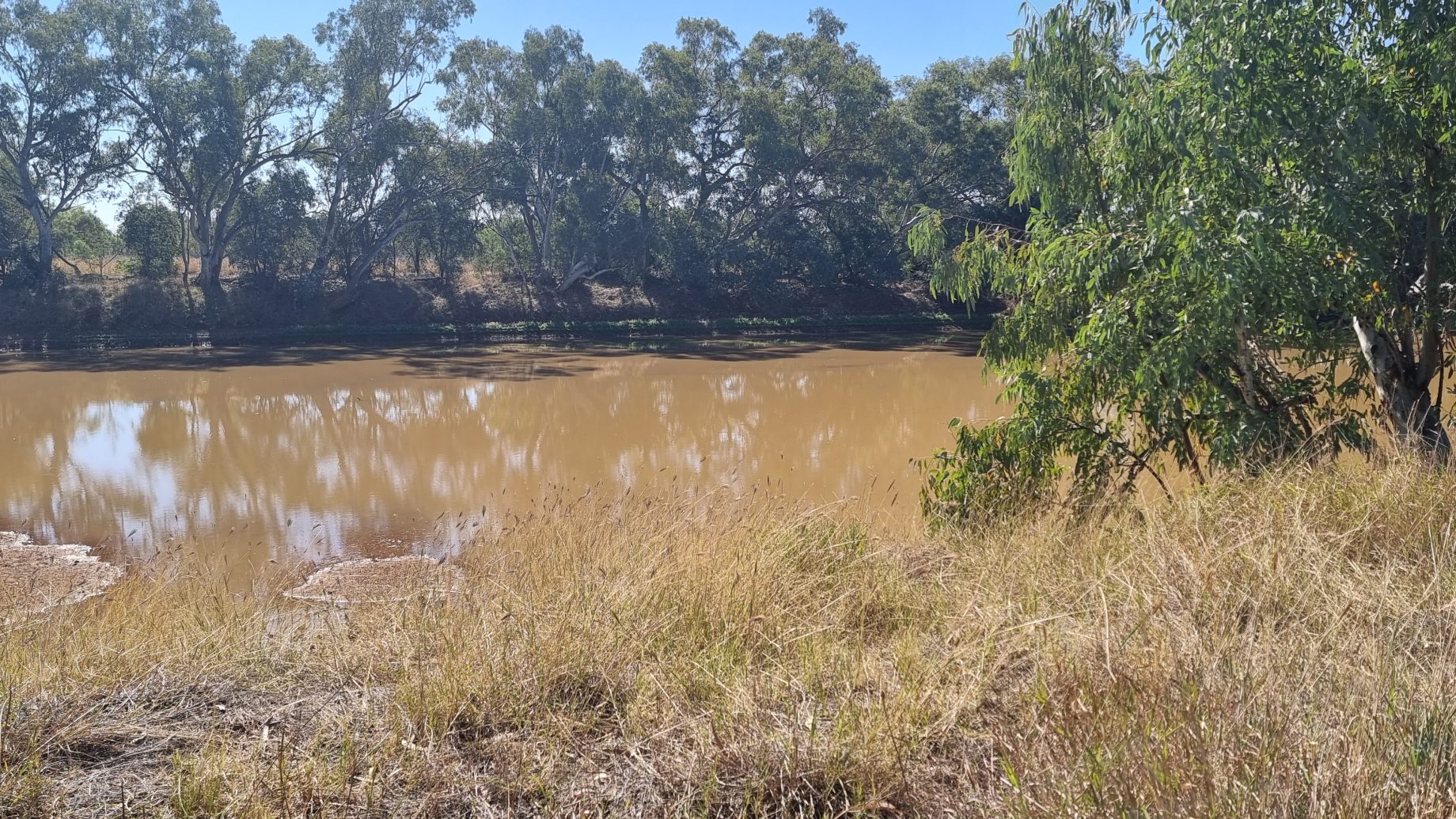
The local caravan park was just down the road with a large grassed area and ample shade trees overlooking the Burke River – much shallower and muddier than it had been after those rains. Wendy booked an unpowered site as they were the ones that had the most shade from the 34C afternoon sun. We set up, then sheltered in the shade while overlooking the river.
To our surprise the Citroen RAID group we saw after leaving Melbourne were passing through Boulia tonight. They had started out east of Perth – following the Anne Beadell track east to Coober Pedy, then down to Maree on the Oodnadatta Track, before heading north to Birdsville and then on to Boulia today. What an adventure for people driving 60-year-old, 2-cylinder cars.
Another day came to an end under clear skies that moved through the colours from vivid blue to orange then deep red before fading through purple to black. The sky was full of stars as we retired for the night.
