Wendy discovered that the birds inhabiting Frewina lagoon don’t sleep at night. They chirruped and whistled to one another throughout the night, not keeping her awake but making it hard to go back to sleep if she stirred. The dawn sky filled with light gradually until the sun finally rose above the horizon and the bright light cast long shadows around the lagoon.
Packups after a short overnight stay are nearly always quick and easy so we were back on the road heading east at 8.15am – after a motorcade of military vehicles had rumbled westward while we were packing up. The Barkly Tablelands are renowned as cattle country, where properties stretch to the horizon and beyond. It’s where road-trains hauling cattle to market are commonly sighted; it’s also where record rains fell at the start of the year, creating an explosion of grasses taking advantage of the ideal growing conditions. As far as we could see there was a sea of waist-high grass waving gently in the light breeze. Cattle in this part of the country are bred to be suited to the harsh climate – a combination of high heat and typically dry conditions. It was 35C during the hottest part of the day today – and it’s still winter!
A sign on the side of the road called out an interesting fact as we continued towards Camooweal – we had entered the Lake Eyre catchment area. From that sign – across to the Great Dividing Range that runs parallel to the east coast – all creeks, streams and rivers in Queensland flow inland towards Lake Eyre in South Australia. That doesn’t for a moment suggest those creeks, streams and rivers are constantly filled with water that is pouring into the great lake; most are dry 99% of the time but every 20 or so years there is sufficient rainfall for Lake Eyre to fill with water. This is one of those years – although the creeks, streams and rivers are dry again after heavy falls in January and February.
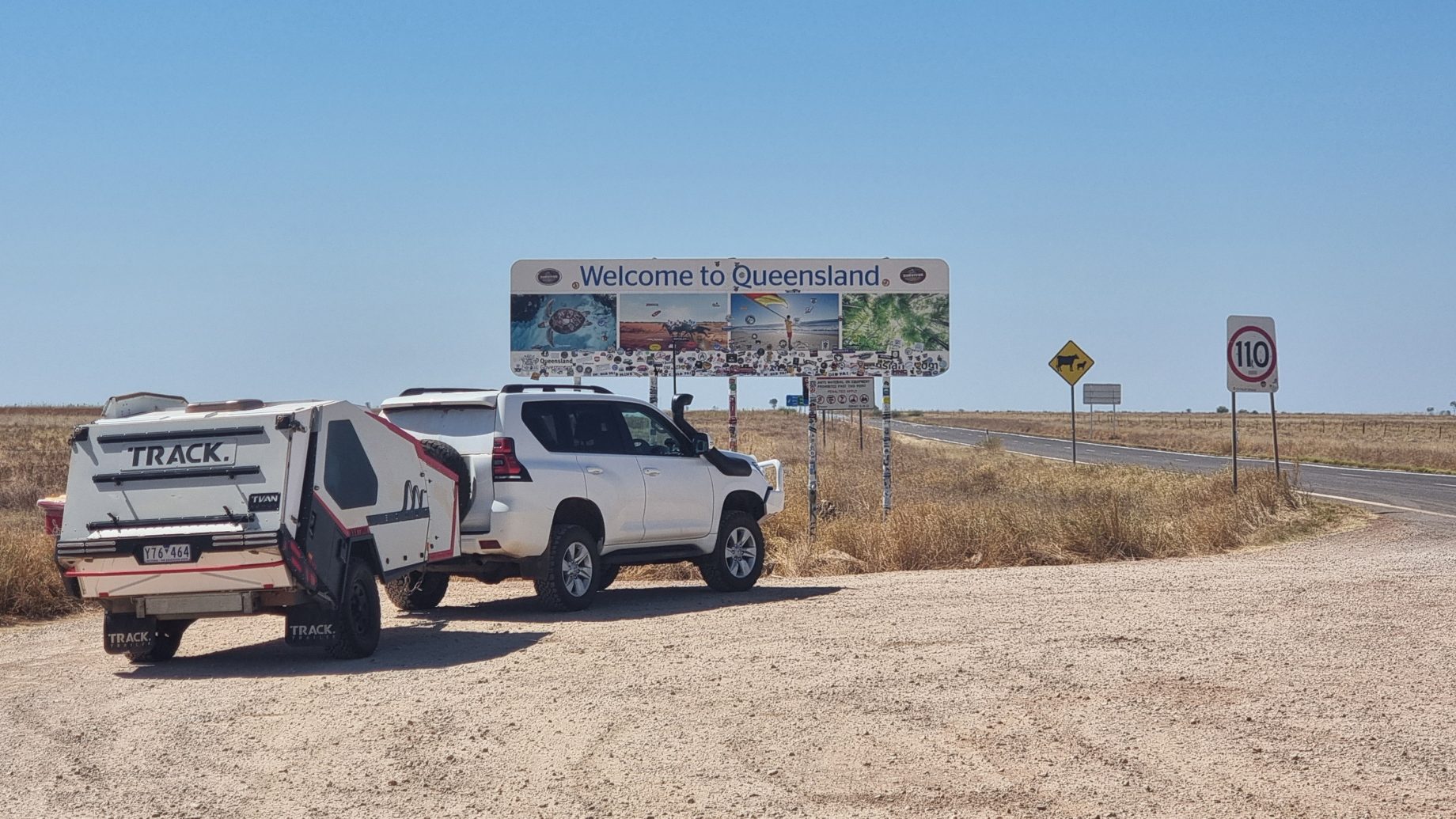
Just prior to arriving at Camooweal we stopped to take a photo at the Northern Territory – Queensland border. It was time to adjust our clocks as we had moved from Central time to Eastern time – a difference of 30 minutes.

Our initial plan was to camp beside another lagoon just to the west of Camooweal. It was 11.45am when we spotted the lagoon, noticing that it was starting to dry out. After a brief discussion we decided to push on.
The landscape changed from flat, well-grassed cattle country to undulating hilly country with rocky, weathered hills supporting little ground cover or trees. Mt Isa was not far away and the hills we were driving through form part of the rich ore body that is the life blood of the region. Silver, lead, copper and zinc are extracted from the ore mined in this area. The biggest of the mines is located in the centre of town, with its above-ground refinery processing the ore extracted from below-ground operations.
Mt Isa is a mining town and PPE (personal protective equipment) is the mandated fashion standard for many of the people in town. Many of the vehicles on the roads are white, two-door Toyota utes with high visibility stripes on their sides, an identifying number on the roof and doors, together with a UHF antenna and sand flag mounted on the bullbar for added visibility.
There is a careful balance of $2 variety stores and opportunity shops occupying a disproportionate number of the shops in town. We received a text message after checking into a caravan park for the night reminding us to secure our valuables and keep vehicles and vans locked at all times. So far we’ve ‘only’ heard two police vehicles driving at speed with sirens blaring and two helicopters pass overhead.
At least the supermarket in town was well stocked and we have replenished supplies for the next few days as we head south into the Diamantina National Park and on to New South Wales.