Friday 9th August – The Journey Into the National Park
There was a strict schedule to stick to today if we were going to successfully arrive at our destination before nightfall. Low tide across Cahill’s Crossing (the causeway across the East Alligator River which has big differences between low and high tide heights) was reported to be at 8.30am – if we mistimed it, it would be a long, 12.5-hour wait until the next low tide. Google maps had confirmed that it was a 28 minute drive from Jabiru to the crossing; we incorporated extra time to fill up with fuel.
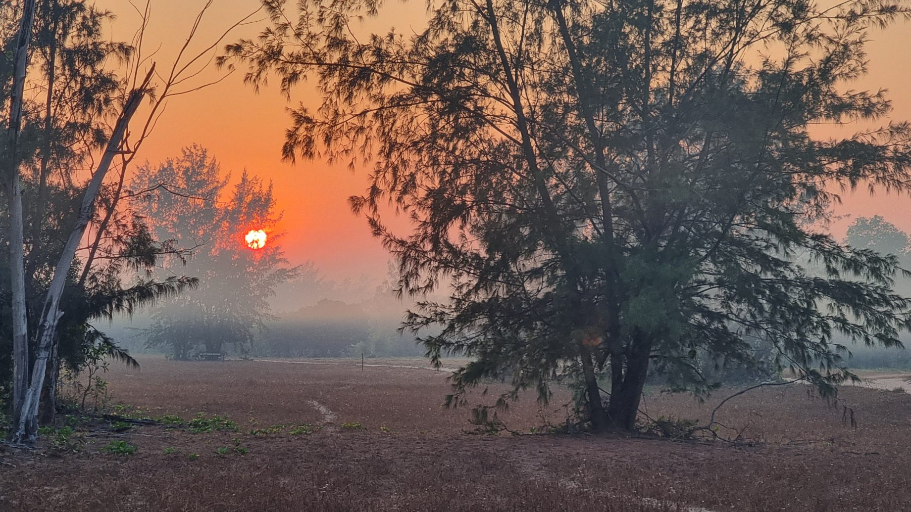
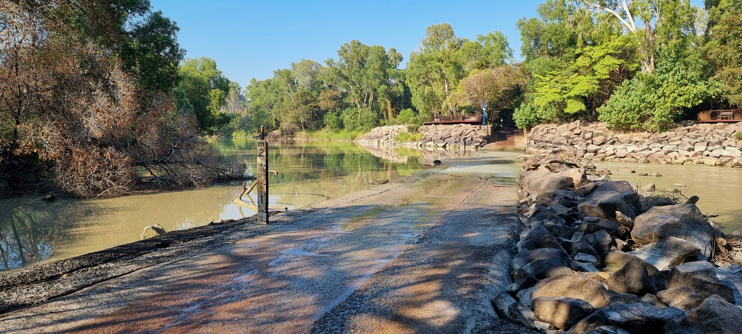
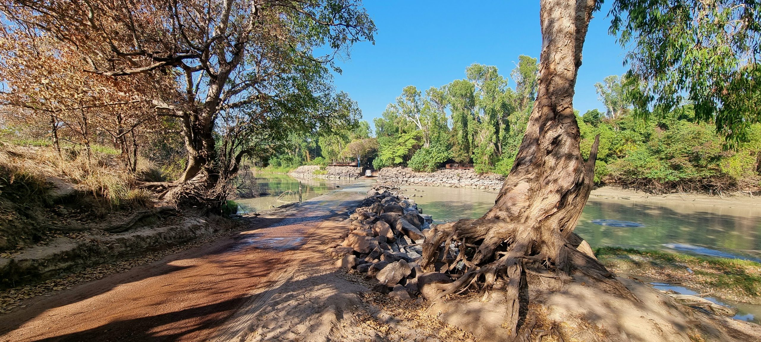
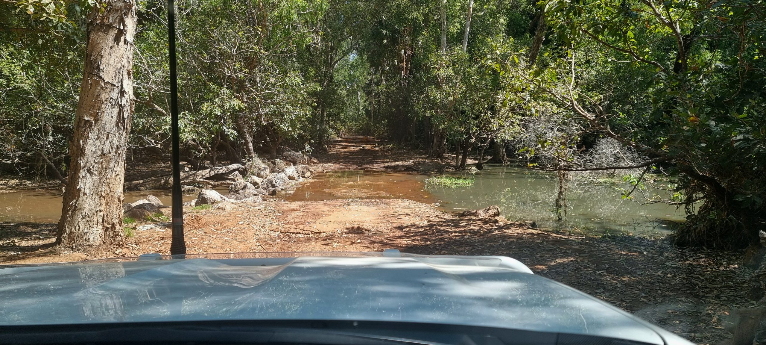
The drive to the crossing was through a thick smoke haze generated by the many cold burns still underway in Kakadu National Park. There were few vehicles heading out to the crossing; those that were seemed to have business in Gunbalanya (an indigenous community once known as Oenpelli, situated just over the Arnhem Land border with Kakadu). We approached the causeway around a sweeping bend and, as planned, the tide was nearly at the bottom with water about axle-deep flowing downstream. With the causeway behind us we pulled up to the side of the dusty track to “air down” all the tyres for the lengthy drive on (as yet unknown) roads and tracks. It was a busy time at the causeway, with service vehicles taking advantage of the low tide to deliver goods to Gunbalanya while residents of that town headed in the opposite direction – possibly to go shopping or seek medical assistance in Jabiru.

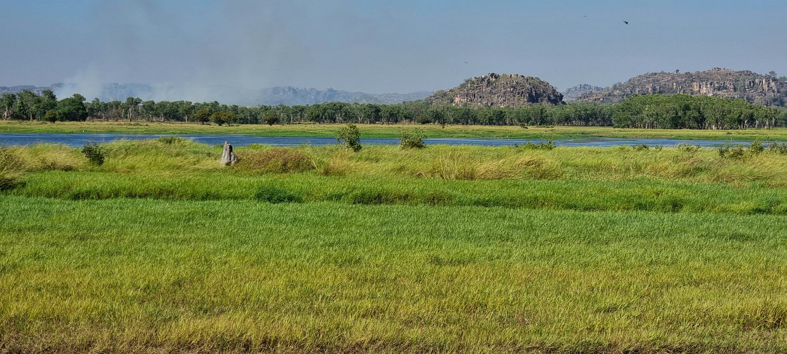
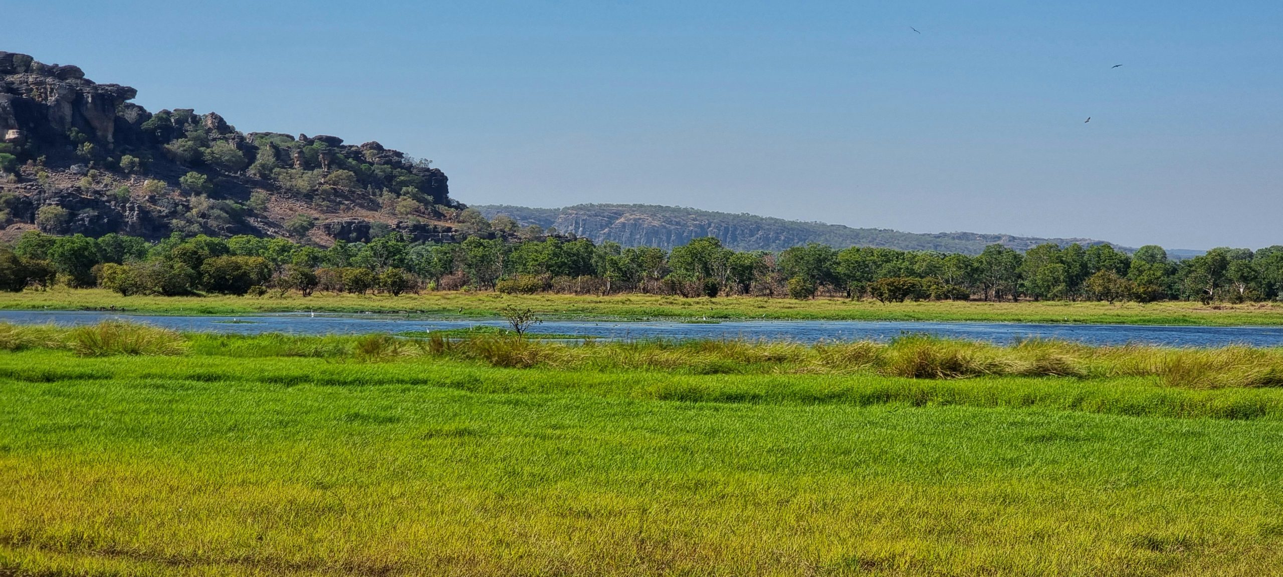
The drive from the causeway to Gunbalanya was in part familiar, as we had ventured a short distance into Arnhem Land in 2022 with a commercial day-tour operator; this was, at the time, the only way to access this part of Australia due to ongoing Covid restrictions within indigenous communities. The country was stunning, with floodplains covered with bright green reeds that gave way to lagoons and waterways of an almost luminescent blue colour. The rocky escarpments looked majestic in the morning sun and the red ochre road we were following reminded us of the colour our Prado and Tvan were turning on this trip away.

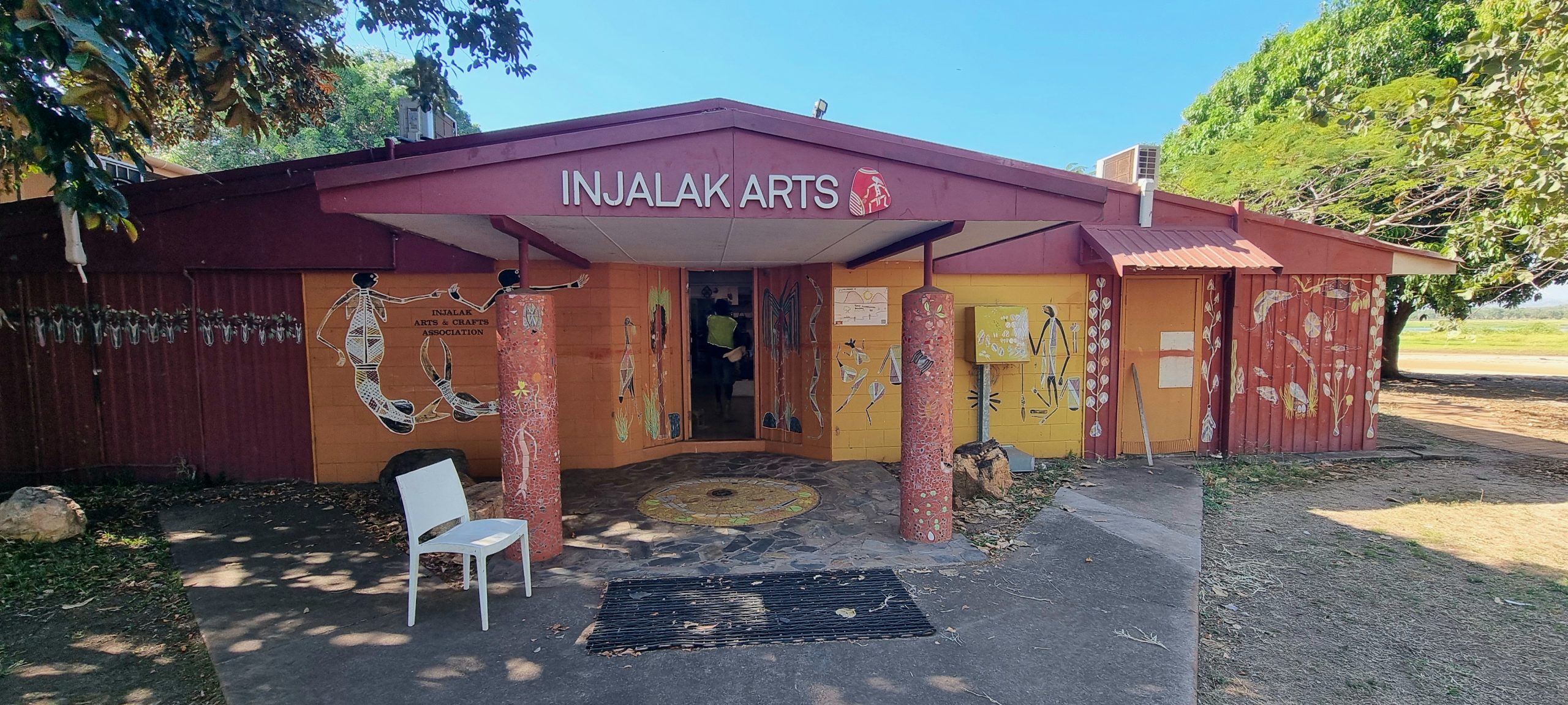
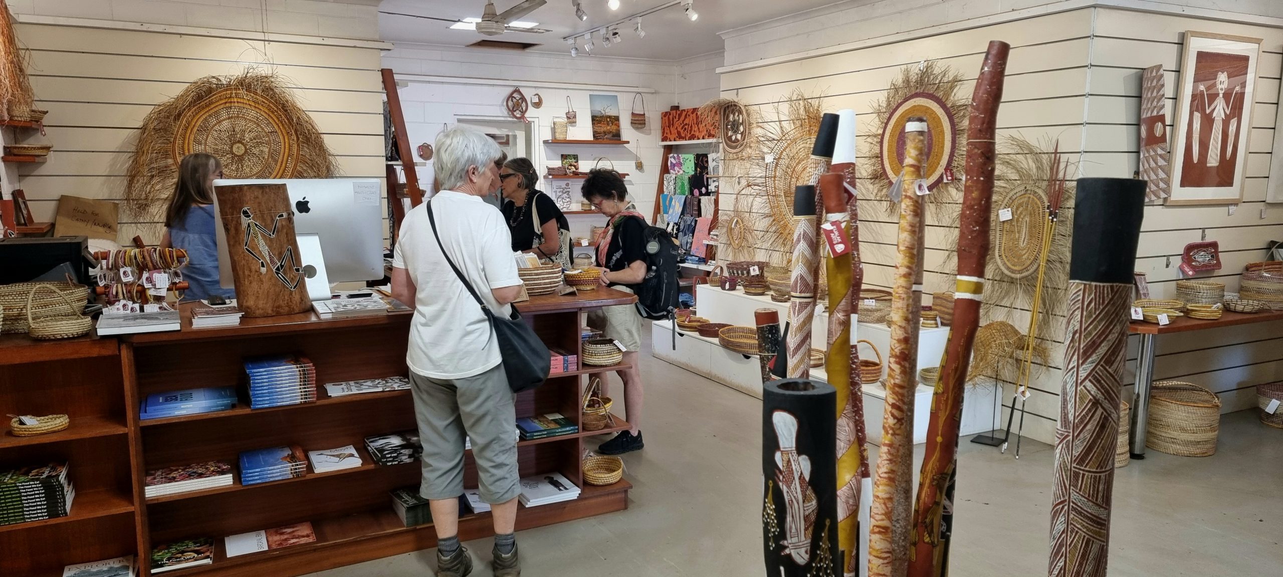
When extending our Kakadu pass we had checked to see if the Injalak Art Centre in Gunbalanya would be open for business. We had this confirmed, so today we drove into the community and straight to the Art Centre. This turned out to be a popular stopping-off / morning tea location for day tours into Arnhem Land. We spent around an hour looking through the works produced by artists from across West Arnhem Land while listening in to the spiel delivered by one of the tour operators. He did confirm that the artists here directly receive 70% of the purchase price for their works, with the remainder used to keep the centre operating. We spent quite some time perusing and came away with a bolt of screen-printed cloth and a small painting. The certificate of authenticity for the latter has already been emailed to us.

Once back in the Prado we followed the gravel road east towards Maningrida before turning in more of a northerly direction. The road we followed was in generally good condition but you had to remain vigilant for potholes, dips and washouts. There were stretches of ‘bulldust’ that almost exploded into the air as we drove through them. Bulldust is like talc – it can be like driving into deep mud if there is enough of it filling deep holes in the road.

The further we drove the rougher the track became. Our average speed dropped from 75 kph to 60 kph (and at times 40 kph). Another small community was passed, with its gravel airstrip and tall communication tower. We passed through the first of 3 vermin-proof fences that stretch the full width of this peninsula. The ‘vermin’ that these fences are attempting to control are mainly water buffalo and banteng (cattle introduced from Indonesia where they are now endangered). The story we later heard from one of the rangers is that the local (indigenous) landowners do not want the Bali cattle removed as a kill can command USD$17,000 from trophy hunters who visit the area on exclusive safari tours. Evidence of the presence of cattle and buffalo was everywhere and, although none were sighted, they obviously exist in serious numbers.
Signs on the main track directed us to the rangers’ offices; eventually one of the live-in rangers, Robbie, emerged and introduced himself to us and other new arrivals. The initial welcome included directions on where visitors are allowed or are not allowed to go. We also had a run through of everything that can kill or maim complacent visitors – including blue-ringed octopus, stone fish, cone shells, western brown snakes, crocodiles, sharks and stingers. We were also warned that dingoes like to scavenge (as do crows) – so don’t leave anything outside that might be mistaken for food.
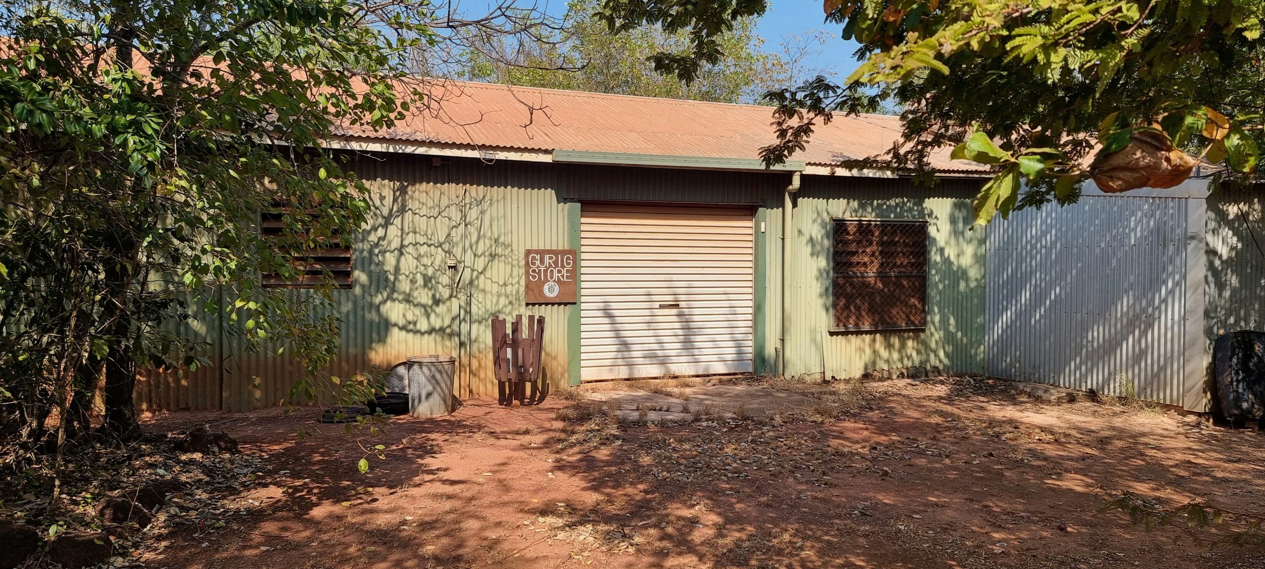
We drove the short distance from the rangers’ office to Campground 1, where generators are not permitted. A walk through the campgrounds helped locate a site that would work for us. There is no concern about finding a site – only 20 people are allowed into the National Park at any one time. Apart from the four who arrived with us yesterday, either one or both of us have chatted to four others so we have already met half of our fellow travellers!
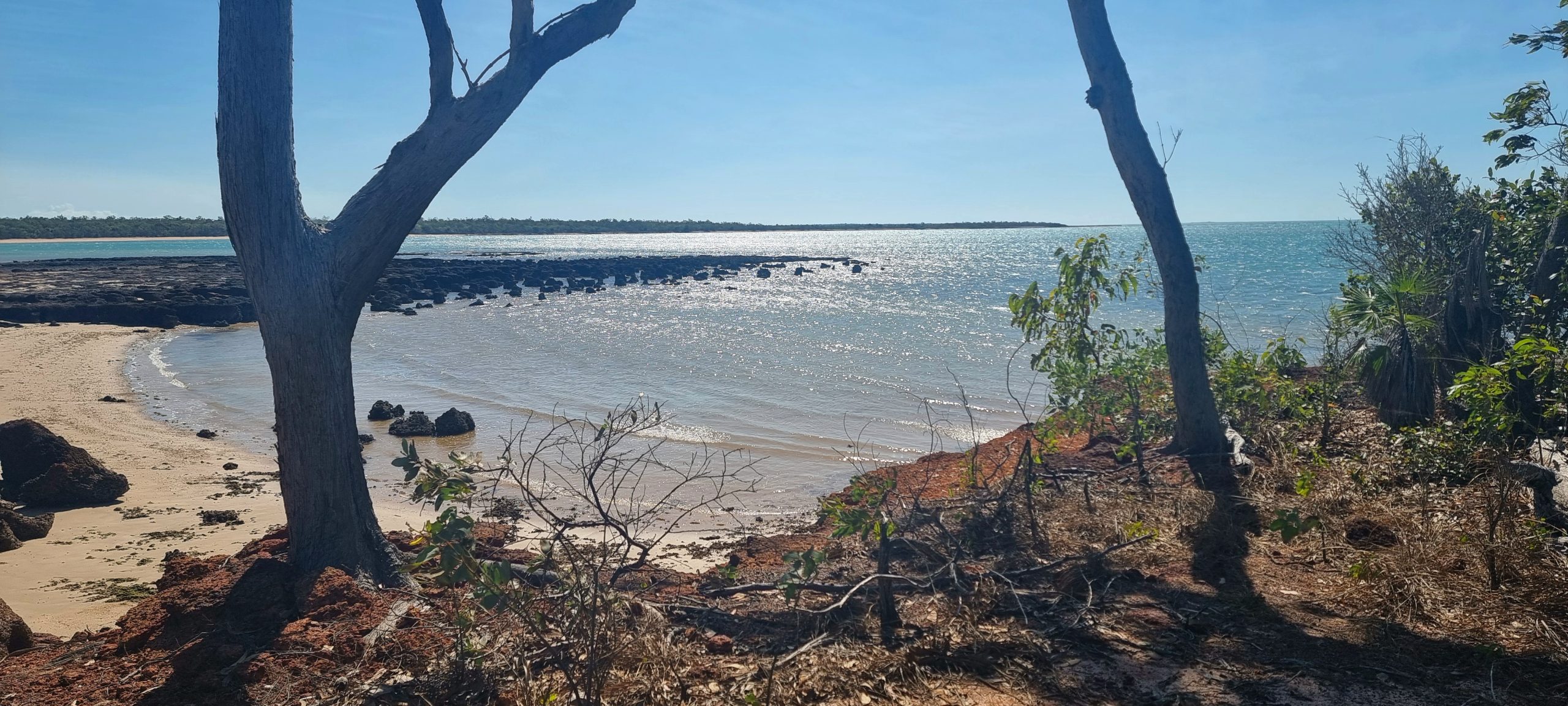
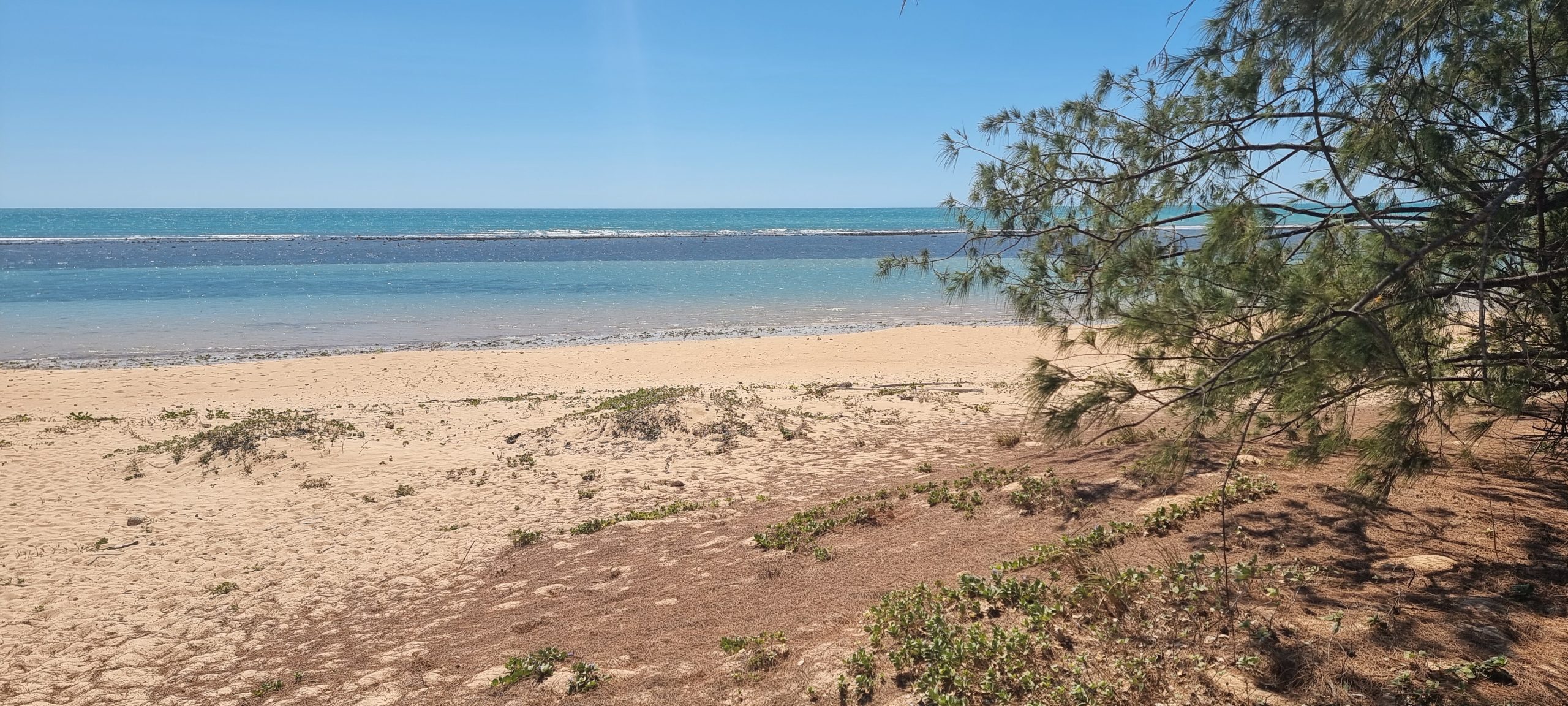
We walked across the main, ochre-coloured track to the north-east facing beach. The sea was choppy but very inviting – except for knowing about all the things in the water that might like to kill us. Our exploration of the Cobourg Peninsula will start at a relaxed pace tomorrow.

Saturday 10th August – It’s all about the numbers
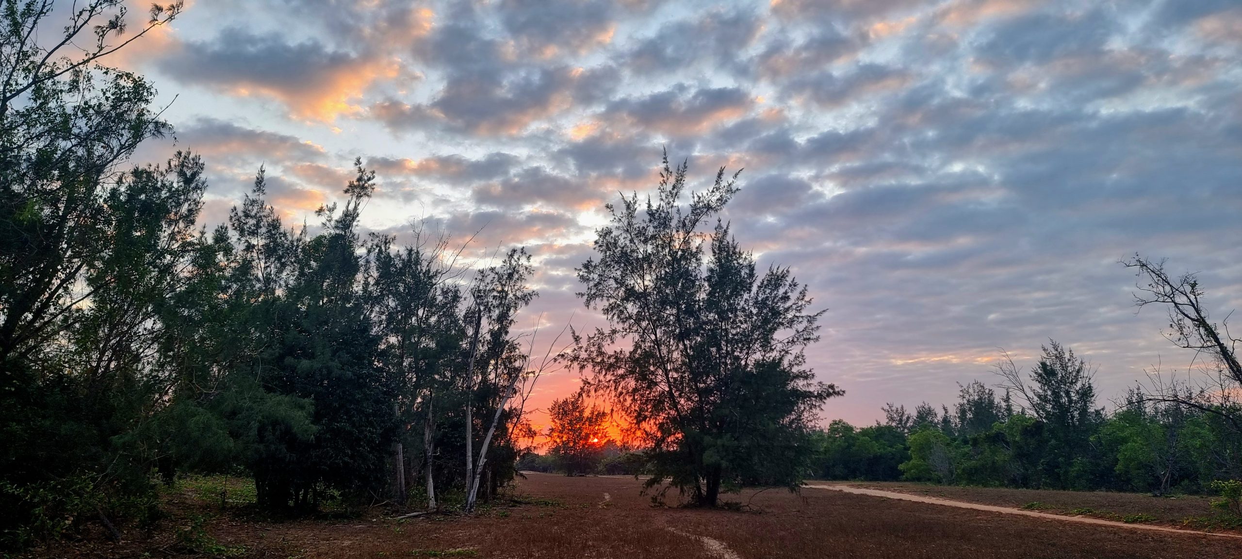
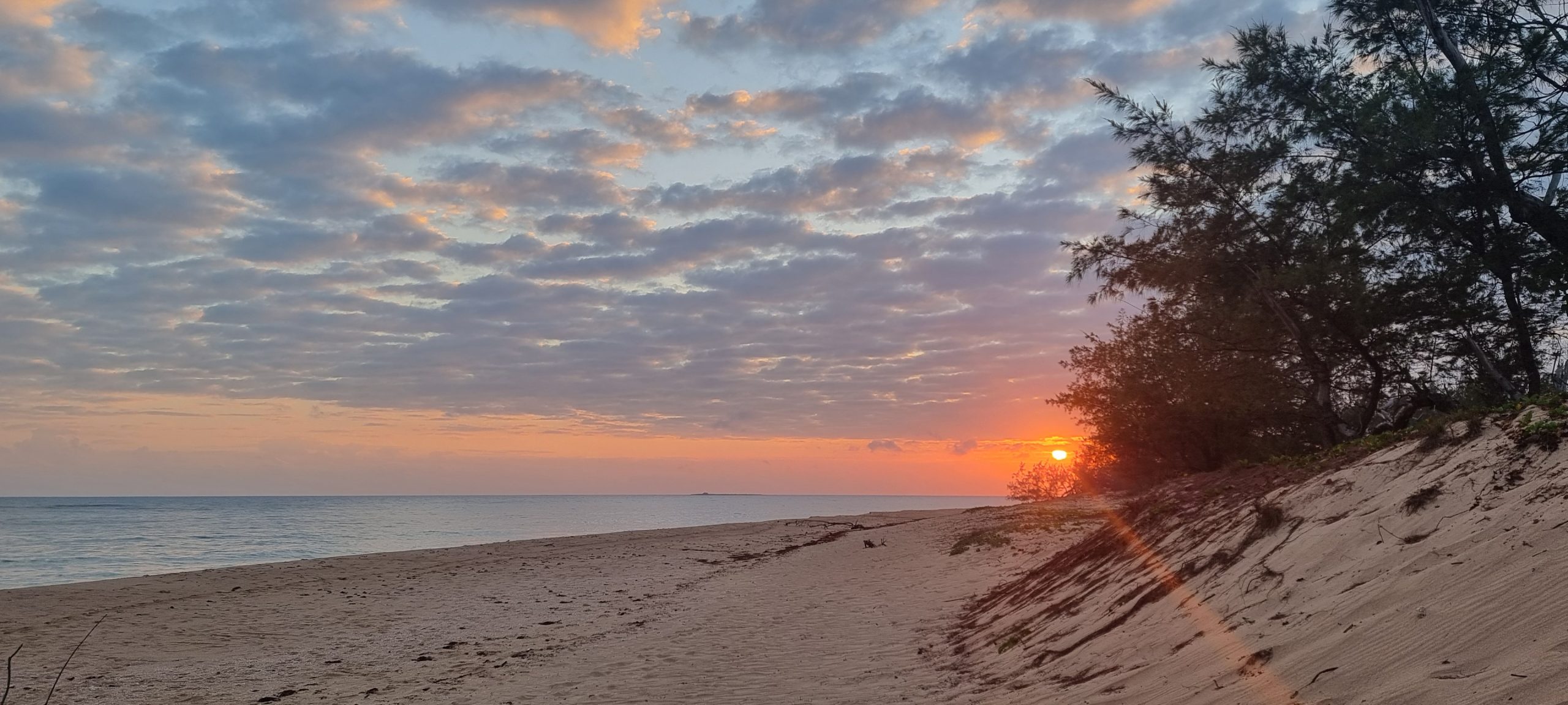
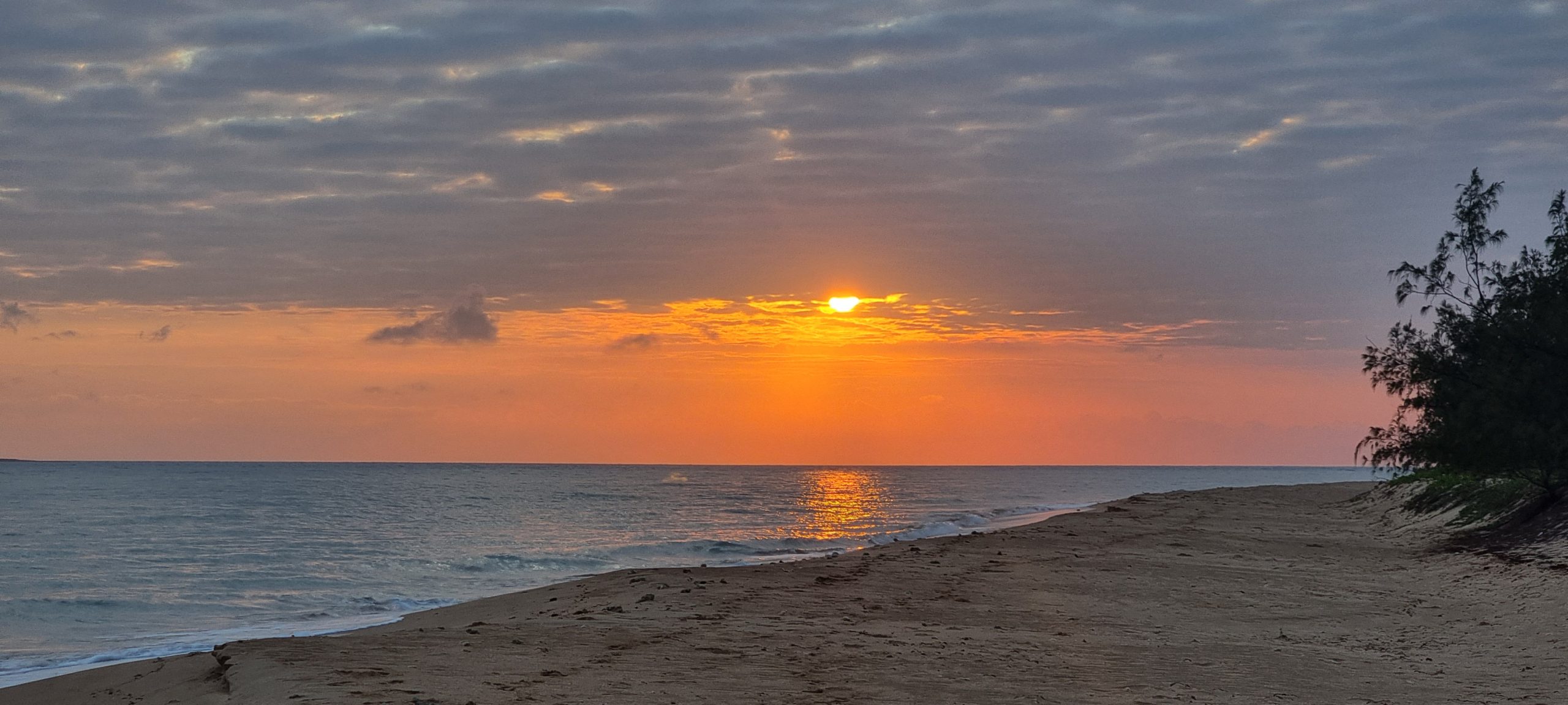
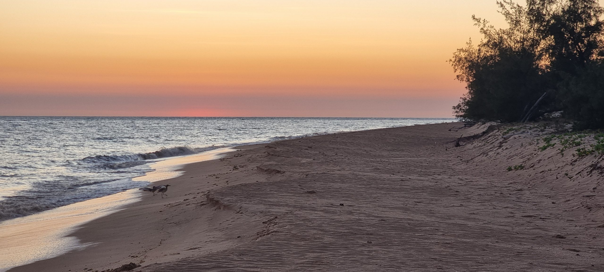
For the first time in ages we slept with the sound of waves breaking on a nearby shoreline. Just before sunrise Chris got up and wandered over to the beach to catch the start of a new day – cautiously. It was a view shared with no one as the other campers were yet to rise.
Our time on the Cobourg Peninsula is governed by two things. Firstly – our permit to be here is only valid for 7 days; secondly – we are reliant on batteries in the Tvan to keep our 60-litre fridge and 40-litre freezer ticking over. To keep the batteries charged we have two solar panels – 1 fixed to the roof of the Tvan itself and another, free-standing panel that we can position to best catch the sun as it moves across the sky (120w and 200w panels respectively).
When we woke this morning the batteries were down to 64% of charge, having worked hard to keep the fridge and freezer running through a warm night. By 1.00pm the solar panels were showing good signs of doing their expected job; the batteries were charged up to 85% with plenty of hours of daylight yet to come. (If we end up using more power than we can replace, eventually the fridge and freezer will have insufficient power to continue working; with daily temperatures around 33C to 34C our food would spoil quickly and we would have to make a call on whether we left early to save the food).
This morning we have familiarised ourselves with the campgrounds. The amenities block is back at the entrance to Campground #1, with two composting toilets and a single hot shower (solar powered). There is also a supply of bore (not drinking) water that we will put to use when the next load of washing needs to be done so we can save our precious drinking water for ourselves to consume.

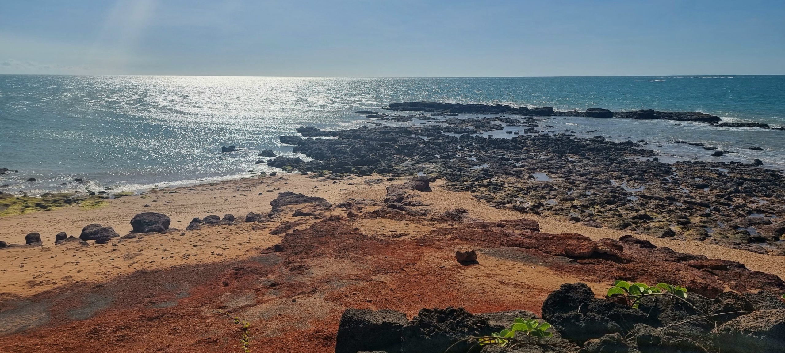
Washing was done (and hung out to dry) by Wendy early in the morning. The drying time from wringing wet ended up being about 3 hours. We walked over to the beach, with Chris noting how much the tide had dropped since his dawn visit. Tides up here are notoriously big – up to 11 metres. Historical records tell of many a sailing ship getting caught up in strong tidal flows and being wrecked on reefs that are common through the waters in this area.
After lunch we set off along the 40km Coastal Drive (track) which follows the coastline south along the eastern side of the Cobourg Peninsula. The drive weaves in and out of secluded bays (although all bays up here are secluded, as there is nobody around). We stopped numerous times to take in the views up and down the coast, parts of which reminded us of the coast on the Dampier Peninsula in Western Australia. The coastal track eventually became a narrow set of wheel ruts with tall grasses growing down the centre. Bush ‘pinstripes’ on the sides of the car were hard to avoid as we continued on to the numerous bays and headlands. At one point our devices began pinging with notifications – we were receiving mobile phone coverage from a large indigenous community on a nearby island. Photos from Zach’s 5th birthday celebrations came through, although there was insufficient signal to download an accompanying video.
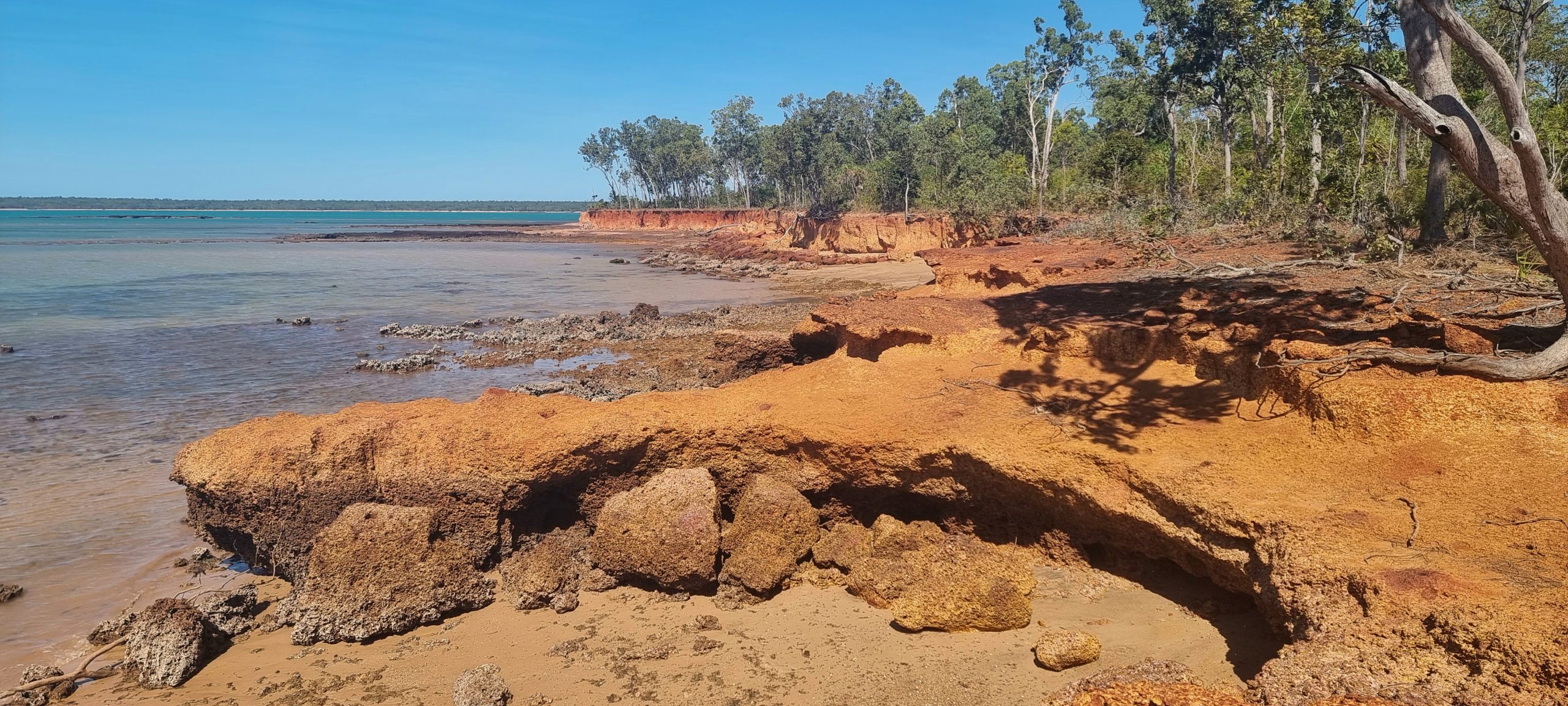
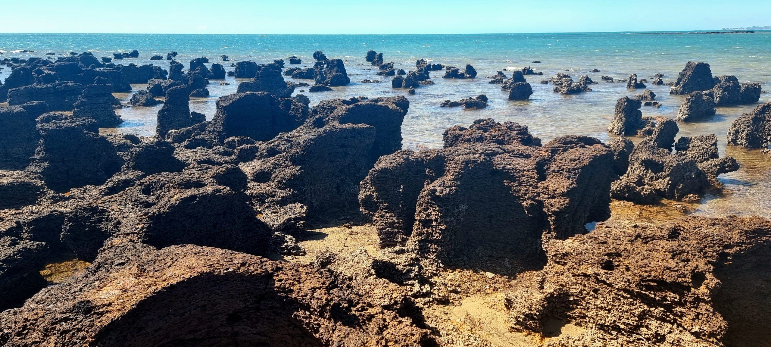
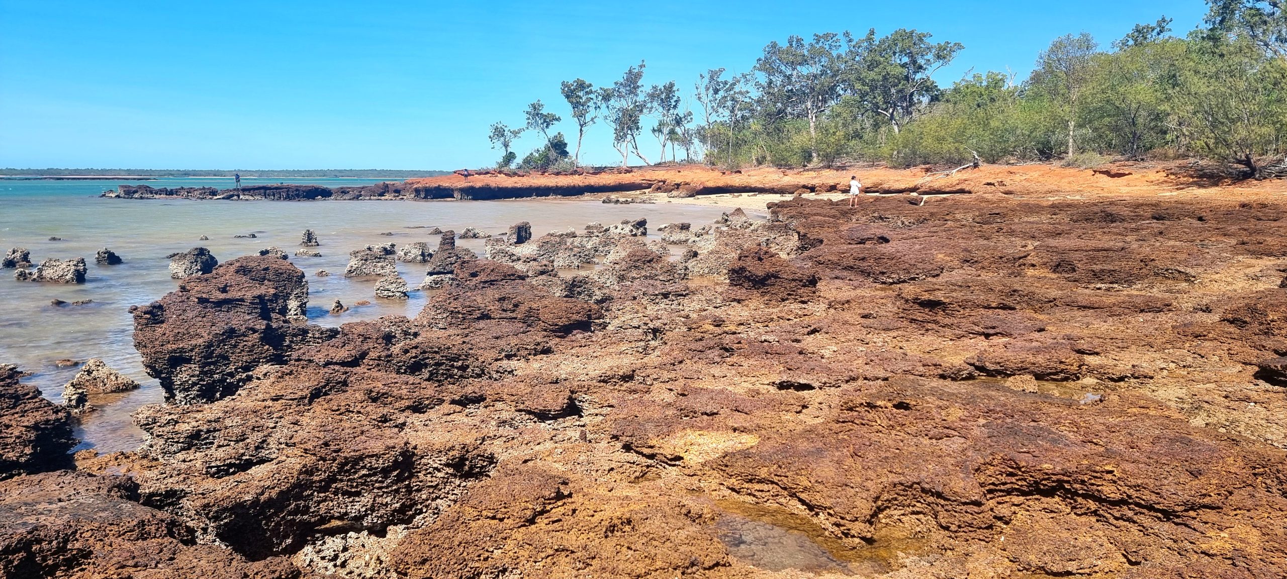

The tide had been going out ever since Chris checked out the sunrise. By the afternoon, reefs appeared where there had once been open water – navigation must be a hazard in these waters. Our coastal drive turned inland and crossed the peninsula where eventually, near Caiman Creek, we joined the main track we had followed in yesterday. Rather than head directly back to our campsite we then detoured via Smiths Point – the northernmost point (on the mainland) of the Northern Territory; possibly also the secondmost northerly point on mainland Australia. A large stone obelisk positioned at the end of the point was used as a navigational aid for ships heading to Port Essington in the 1840s (the ruins of this original settlement in the north of Australia remain on the adjacent peninsula to where we are staying). We also keep looking seaward for a sighting of an ocean-bound crocodile but so far without luck.


On returning to camp we checked the all-important numbers to find our batteries had been recharged to 95% (which is where they were when we pulled up yesterday). This was a 30% increase on where they started from this morning. It this pattern continues, and we see no reason for it not to, insufficient power will not be the cause for us leaving the campsite early.
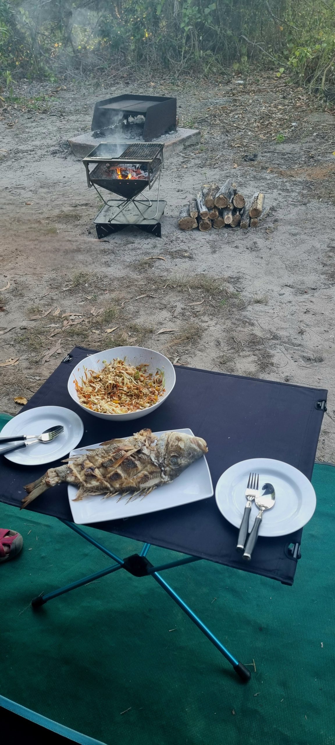
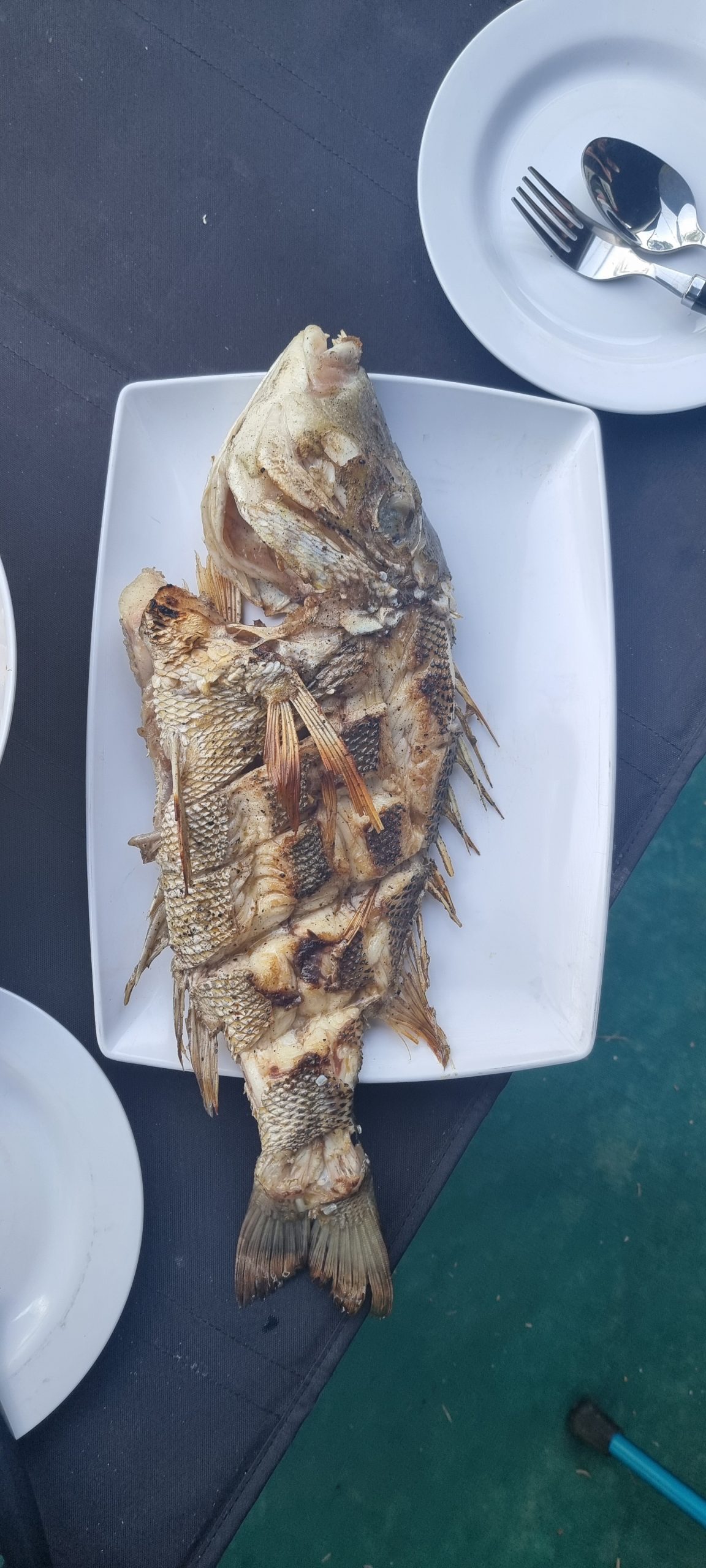
Our closest neighbours, two fishermen from Bright in Victoria, had a more successful day on the water today than they have had previously and popped over to offer us some of their catch. We ended up with a scaled, cleaned and slashed spangled emperor, which we shallow fried for dinner over the hot coals of our barbecue. To keep in their good books we returned the favour (to a much lesser degree) by giving them a bowl of freshly made Asian coleslaw to accompany their dinner. Tomorrow is their last full day here, so we’ll keep our fingers crossed that the seas are kind to them again!
Sunday 11th August – The facts about the National Park
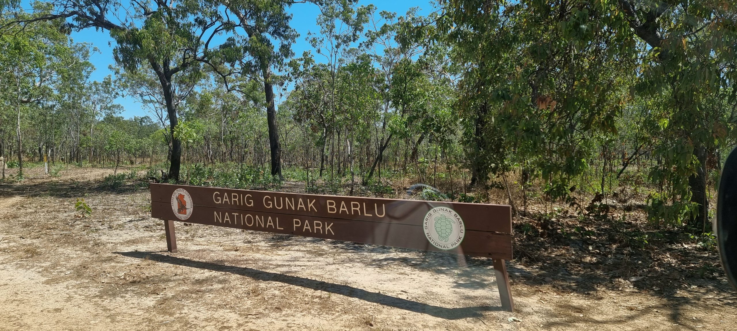
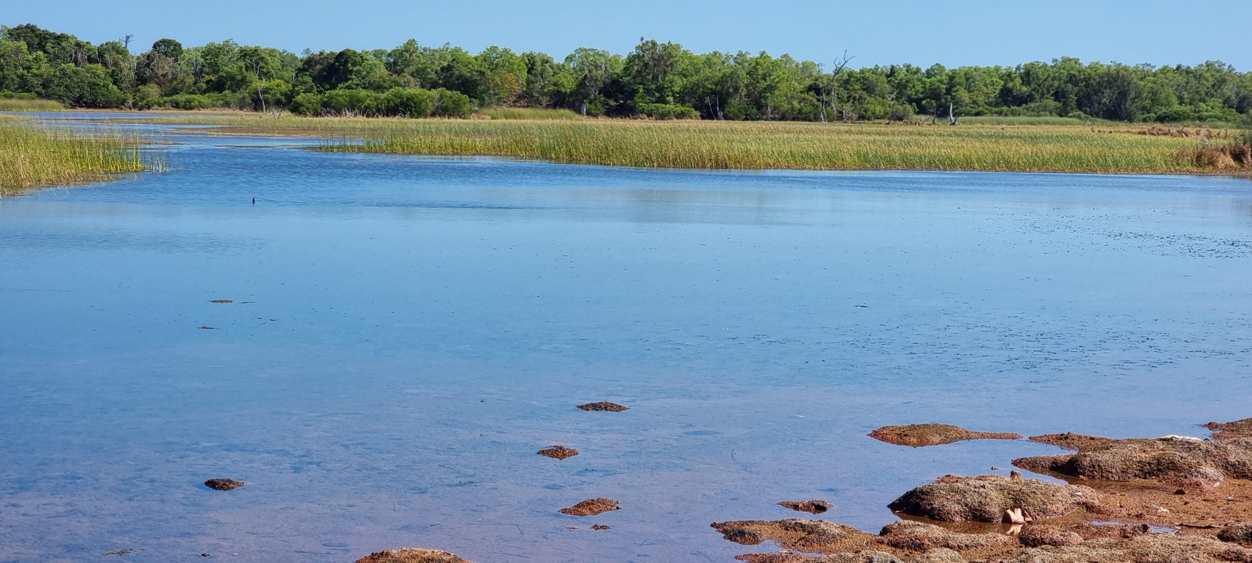
The name of the park is translated as Garig (a local language name for the central areas of the peninsula), Gunak (land) and Barlu (deep water). It covers about 4,500 square kilometres and consists of a mosaic of sandy beaches, dunes and coastal grasslands, mangroves, rainforest patches, swamps, lagoons, coral reefs, sea grass meadows and rich marine life.
The park is home to the worlds largest wild herd of banteng, a species of cattle native to Southeast Asia which are endangered in their native habitat. The area has an interesting ancient and contemporary history. Aboriginal people have lived in the area for over 40,000 years. Macassan traders visited the area for centuries, where they fished for trepang (sea cucumber, or beche-de-mer). In 1838 the early British settlement of Victoria was established at Port Essington, but it was abandoned 10 years later and the settlement of Darwin was created further to the west.
The park protects rare species including dugongs and six marine turtle species. It was the first site to be recognised as a Wetland of International Importance under the ‘Convention on Wetlands’ (commonly known as Ramsar). It was listed on 8 May 1974. There are now 67 Australian Ramsar wetlands, including Kakadu National Park.
From Jabiru to the rangers’ station at Black Point it is 310 kms via unsealed roads (4WD only) which are only open during the dry season from May to October. Roads can be closed for ceremonial reasons with little notice. The roads are narrow, dusty and corrugated with blind corners and dangerous bends. No fuel is available in the park so visitors need to carry sufficient for the return journey.
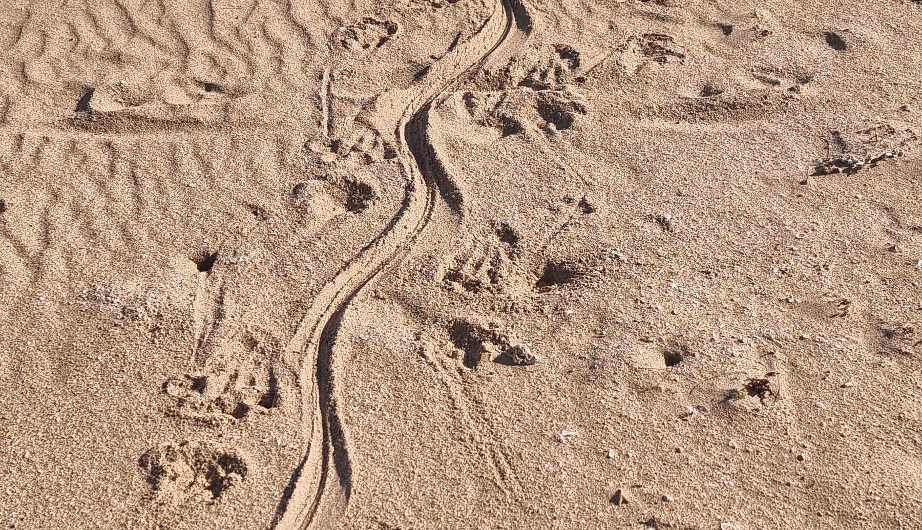
Being committed to a multi-day stopover means there is less pressure on rising early to fit everything in that needs to be done within a limited time span. Even so, Chris was again up at dawn and wandered over to check out the beach opposite our campsite. Routine chores were attended to, including another load of hand washing. Once that had been hung out to dry we set off for a walk along the beach near our campsite. The two fishermen friends camped near us were preparing their boat for another day on the water. Peter mentioned that there were fresh crocodile tracks leading from the ocean to the wetlands down near the Crocodile Crossing sign (only in Australia could such signs be found). Sure enough, the clear tracks of a 2metre+ crocodile were spotted – tracks that coincide with the swagger these reptiles adopt when walking on land. Imprints from the croc’s feet could also be clearly made out either side of the the tail swish; their size gave an indication of the croc’s overall length. Fishermen we subsequently passed further up the beach announced that they had surprised a 2-3 metre crocodile that was basking on the beach the previous day. On sighting them the creature made a hurried dash for the water.
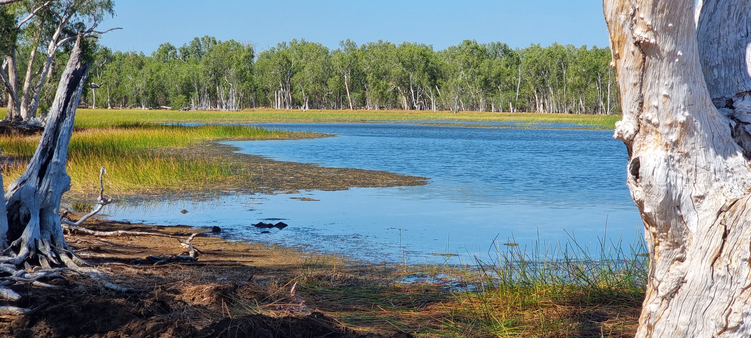
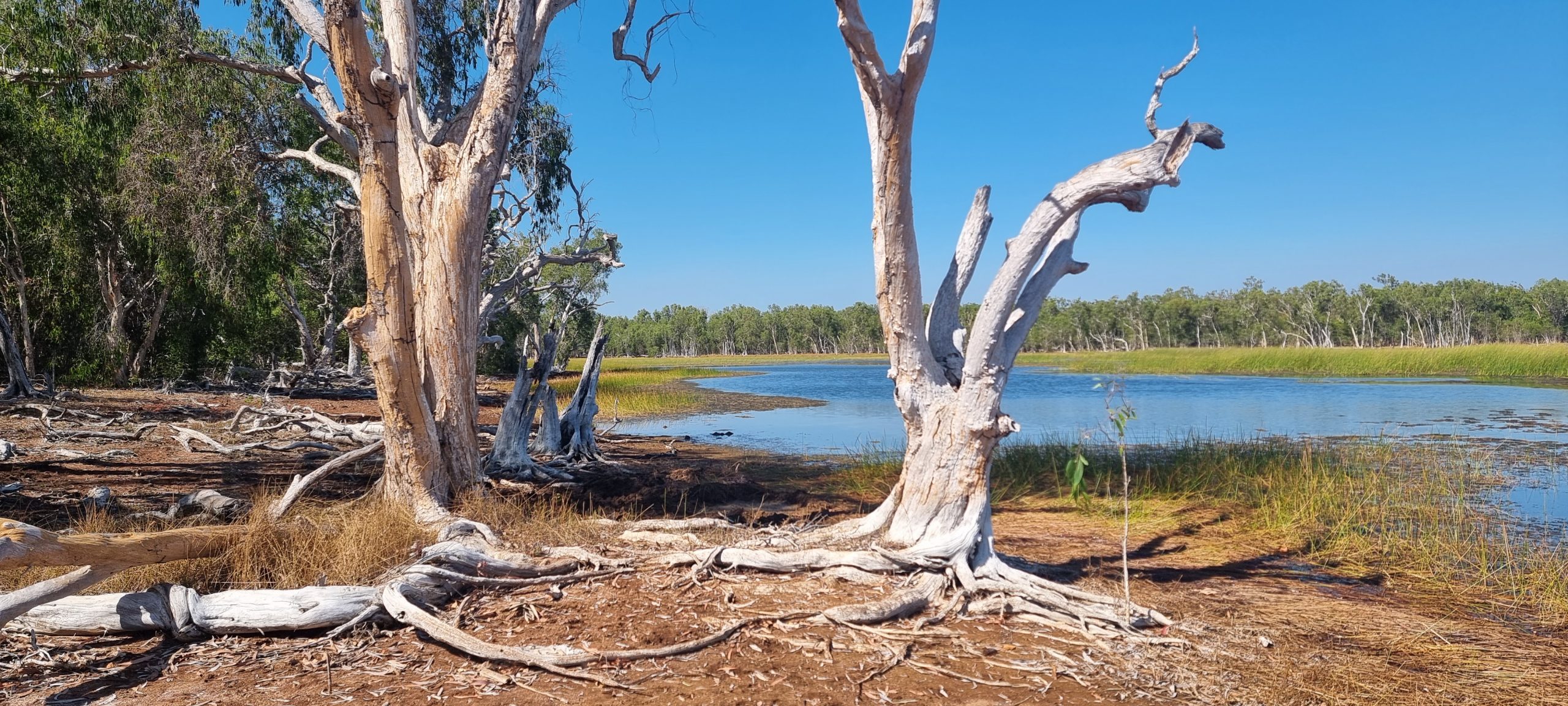
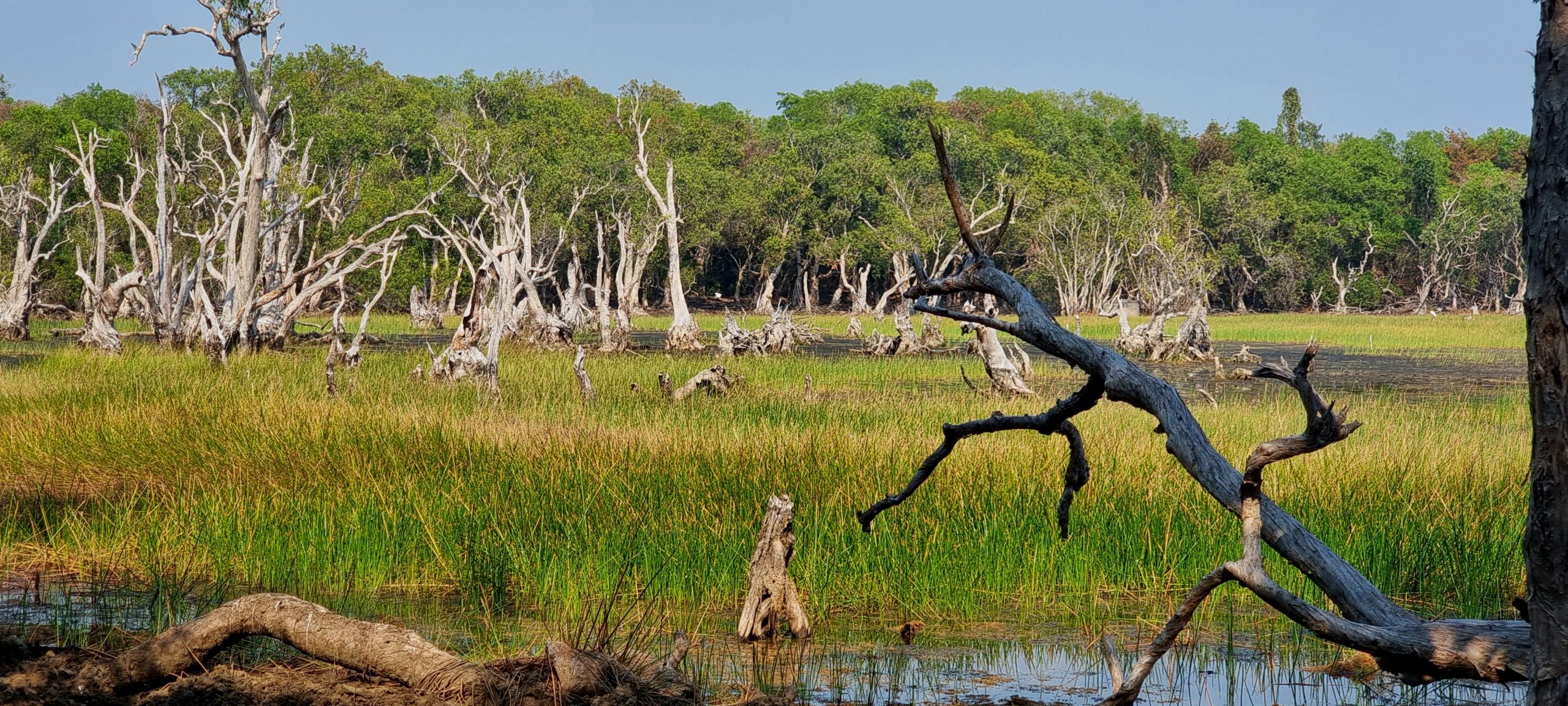
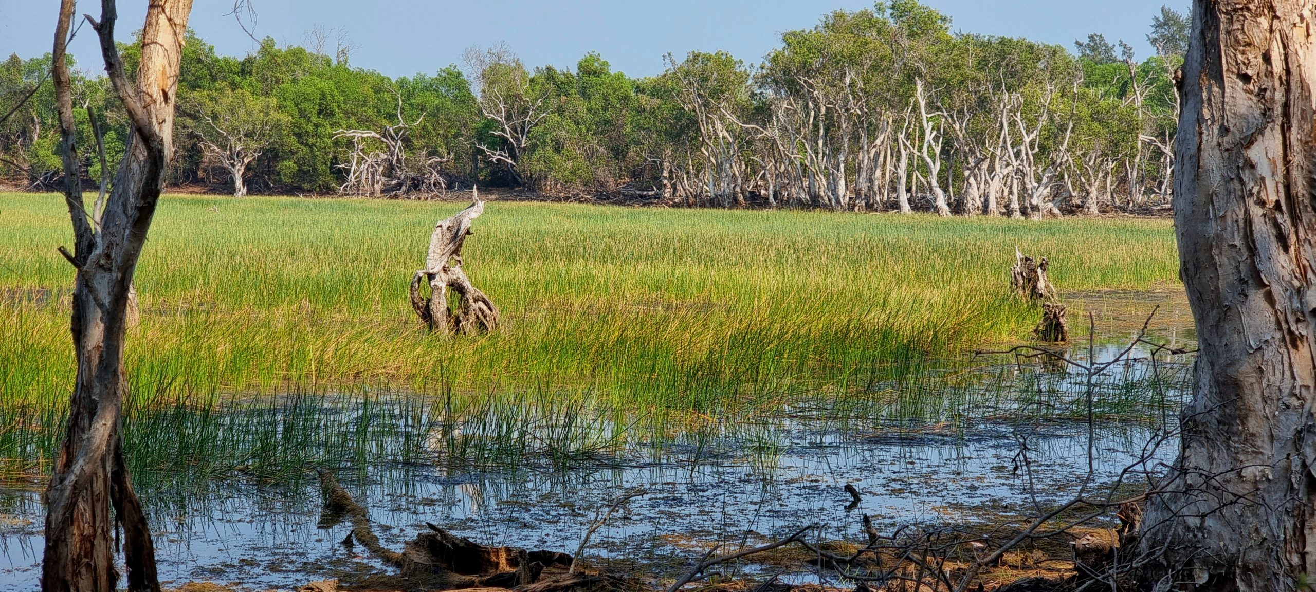
Before the day got too hot we ventured out in the Prado to undertake the Wetlands Drive which circumnavigates a large wetland area in the centre of the peninsula. Overnight the temperature drops to around 22C-23C, but once the sun is up it rises to the low 30s. Eventually the temperature starts dropping by around 4.30pm, making the early mornings and later afternoons the best part of the day. The Wetland Drive turnoff is south of the campgrounds, not far from a beach headland where we managed to get some weak mobile phone signal yesterday. We took a quick detour to the headland to check messages and emails before retracing our steps slightly and heading off on the Wetlands Drive. The drive was designated as one way only; fortunately we were headed in the permitted direction.
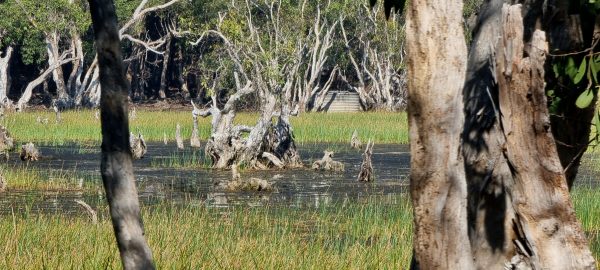
Fresh evidence of the endangered banteng cattle was everywhere and at times it was difficult avoiding the extensive, often freshly dropped, ‘evidence’. The track twisted and turned its way through dense bush, making any possible sighting of the banteng difficult. Eventually we entered a clearing on the edge of the wetlands, with the greenery of reeds growing in swampy conditions around extensive areas of open water. Birdlife was prolific with egrets and multiple types of plovers observed. Signage at each of the clearings we came to made it unambiguous that swimming was not an option and that we should keep clear of the water’s edge.


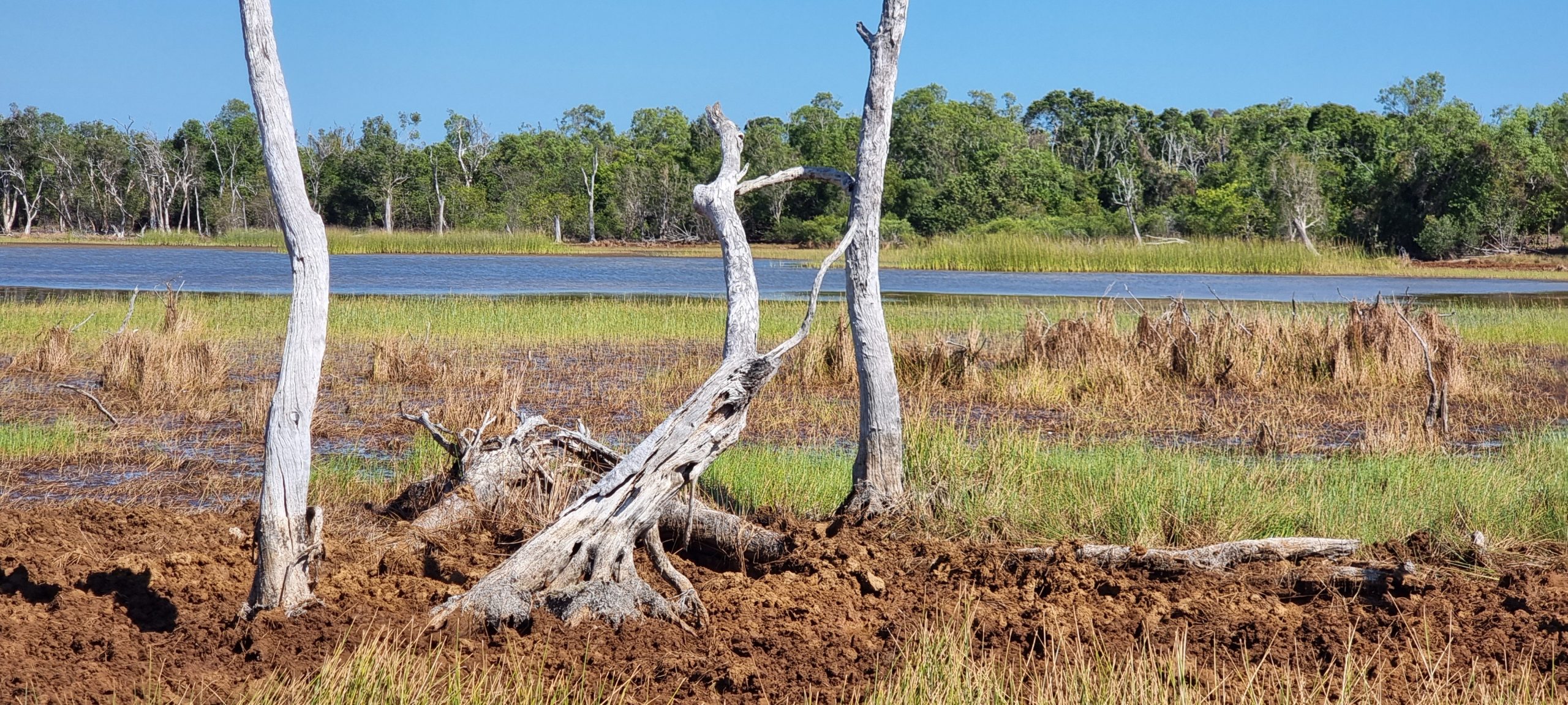
The wetlands, even during the dry season, were extensive and one could imagine that the area would often be buzzing with activity as migratory birds spent the summer months here. Eventually the track turned away from the wetlands, heading west to join up with the main track we followed to get here a few days ago. We stopped before rejoining the main track to collect further firewood to fire up the BBQ and cook tonight’s dinner.
The road into the rangers’ office is also an access road to the Black Point boat launching ramp and we decided to check this out while in the area. The fishermen who provided us with a beautiful spangled emperor fish for dinner last night had obviously launched their boat from here this morning. Their 4WD and boat trailer were safely parked in the shade and they had filled out the notice board beside the boat ramp, providing their names, boat rego, time of departure and planned return time, plus a UHF channel to contact them on should the need arise. A smart safety measure when boating in remote and potentially unfamiliar waters.

It is very enticing to go for a quick splash in the crystal clear waters surrounding the peninsula as a way of finding relief from the midday temperatures and humidity, but it is never going to happen for us. Tourism and pearling are the main business endeavours in the region and it is difficult to see that changing too much in the future. The distances everything has to travel to get here, the challenging climate (with a wet season that closes everything down and a dry season that averages 33C-34C every day for a couple of months) and the many creatures found here that want to bite or sting you are just some of the challenges that would need to be dealt with.
There is a cooling breeze blowing as we sit in the shade reading and writing. Soon enough it will be time for a cool drink before dinner is cooked on our BBQ using firewood collected earlier in the day. Peter and Brian from the adjacent campsite have been over again bearing fish. Seems as though they had a successful day on the water and caught more than they needed. Two golden snapper are wrapped up in our fridge until dinner time tomorrow.
Monday 12 August – Nothing to do and all day to do it in
Chris was up and about again before the sunrise; it’s a beautiful time of day with temperatures in the low 20Cs and generally no breeze. He wandered over to the beach, looking for telltale signs of visitors during the night and to watch the sun rise on a new day. No fresh crocodile tracks had been left in the dust of the track that passes the campground, but other tracks had and they were not so easy to identify. A photo of them was taken for future reference.
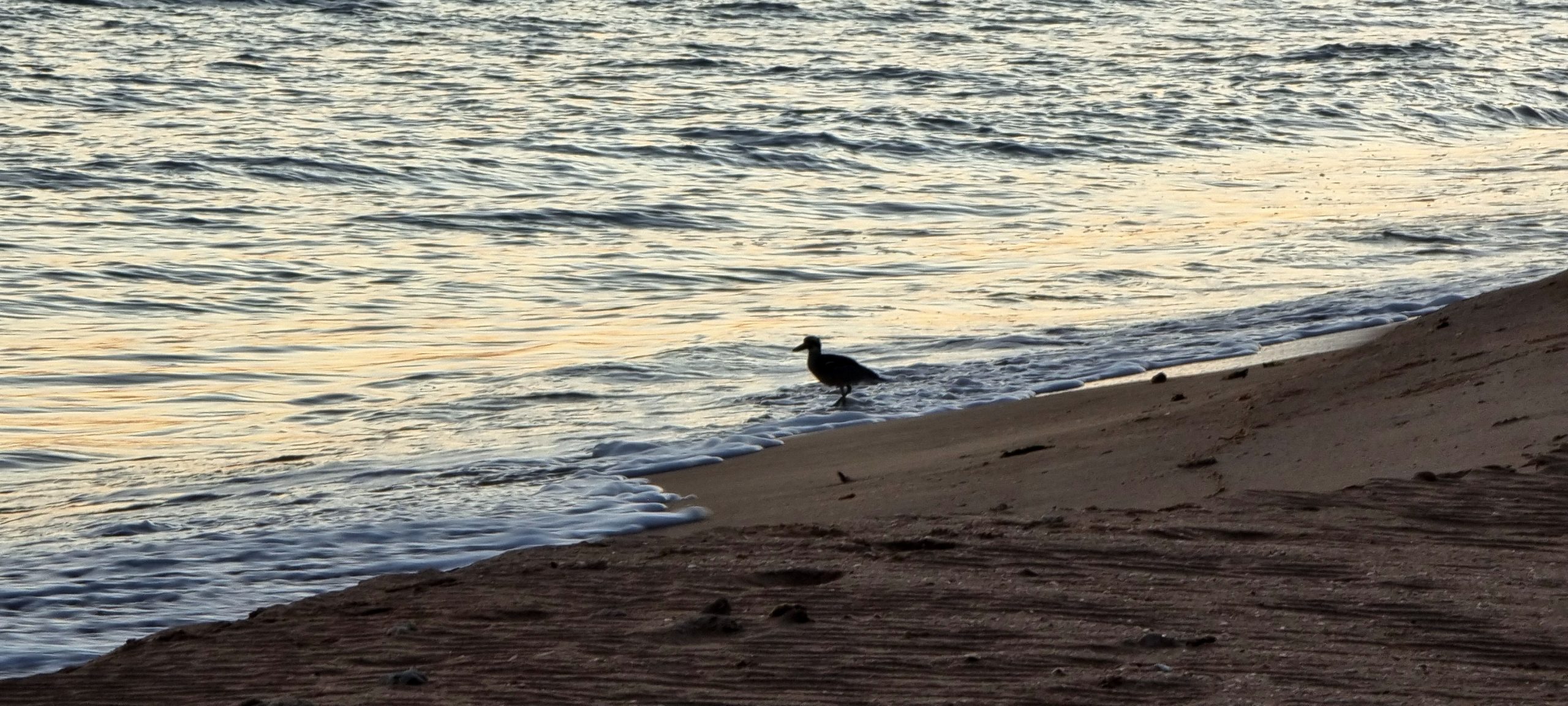

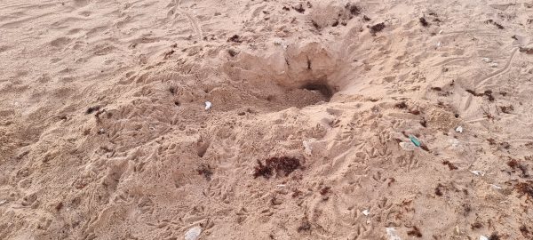
Down on the beach it appeared to have been a lively night. Something had dug its way into a turtle’s nest for a feed of eggs and, given the footprints left in the freshly dug soil, larger sea birds had gathered to pick over the scraps. Chris took a video of the sun rising over the sea, with fingers crossed that nothing would be sneaking up behind him while he stood still to avoid camera shake.
A chance meeting with a camper new to the park gave rise to many questions about what to do and see on the peninsula. Chris was asked about a rock art tour and where it might start from tomorrow; Chris advised that the only tours he was aware of were one to the abandoned Victoria Settlement and a walking tour being conducted by one of the rangers tomorrow morning. Wendy later met up with the same woman who repeated questions about a rock art tour that starts from Injalak. Wendy explained that Injalak Art Centre is based at Gunbalanya near Cahills Crossing – about 280 kms from here. The couple don’t appear to be fully apprised of the requirements of their bookings.
Robbie the ranger was doing his rounds as we were transferring diesel fuel from jerry cans to the petrol tank of the Prado. Robbie went about emptying the bins, telling us he had noted that we had fish 2 nights ago – clearly he picks up a lot of information by looking inside rubbish bins. He identified the remains as that of a grassy (not spangled, as we had thought) emperor. We quizzed Robbie about the tracks left in the dust on the main track – Chris had taken a photo – and he immediately said they were from banteng. The cattle drag their feet as a result of inbreeding, thus leaving a confusing set of prints behind in the dust. Chris also showed Robbie the photo of the turtle nest that had been uncovered on the beach overnight; Robbie suggested it was most likely unearthed by a goanna, and confirmed it would have then been picked over by sea birds.

We had been told that a weak mobile network signal could be found in one small area of the park, emanating from Crocker Island which is some 30 kms across the water. We accidentally stumbled across the best (only) place to pick up the signal on the day we followed the coastal drive. We have subsequently been back a couple of times to complete administrative tasks and check the news headlines. The signal is too weak for voice connections. While out today we went in search of firewood to top up our dwindling supplies. Tonight we had two more fish to cook on the BBQ, so we needed to be ready with plenty of hot coals.
Another conversation with fisherman Peter confirmed he and his mate Brian are off early tomorrow morning (around 3.00am) to make the 11.30am low tide across Cahills Crossing. They are towing a dual axle boat trailer, with all their camping gear packed into the boat. It will be a slow and careful drive back for them. We also learnt that Brian is an Ovens Valley viticulturist who sells the grapes he grows to his wine-making wife (they apparently make an award-winning Chardonnay). He has time to get away after harvest and pruning, but before spring when things get busy around the vineyard again. Peter is an electrician from Port Fairy with a shared interest in fishing. From here they are headed east, with stops at Limmen camp, Seven Emu Station, King Ash Bay, Karumba and Cooktown – before heading home to Victoria in October. We have appreciated the fish they provide us each day, they enjoy the freshly made salads we give them in return.
Some firewood was eventually collected over near Smith Point, where we bumped into our other neighbours who are also travelling with a Tvan in tow. They are a young couple who have been on the road for some time and pick up work wherever they can. From all accounts, the more remote towns and communities will take on anyone willing to try their hand at any manner of task(s). Chris was interested to learn more about their practical experience with StarLink – the pros and cons. He wandered over later for a chat.
StarLink is an Elon Musk product that has been around for only a couple of years. It is a satellite-based communication network that originally started out as a solution for remote communities to “get connected” at a reasonable price. A network of low-orbit satellites have been put in place, providing near 100% global coverage with transmission speeds that often exceed what is provided through ground-based connections. The system has evolved to also provide a mobile solution – including a niche market in Australia’s remote tourism where people can conduct business, watch online programs, make and receive voice or video calls when on the move.
In chatting with the young couple who have been using StarLink for 12-18 months they were not only enthusiastic about the ease of setup (which is all done through a phone-based app), but also the quality of service regardless of where they have been within Australia. The main drawback seems to be that the current mobile solution relies on 240 volts and to use the setup in their Tvan they have to run off an inverter – a relatively significant drain on their batteries. As a result they try to keep their usage down to 1 hour per day when using the system off grid. The good news is that there is a more compact, 12-volt version becoming available soon – this should address the power draining issue. Chris will no doubt do more research on this topic when we next have reliable internet connectivity.
Tuesday 13 August – “Walking with a foot in two worlds”
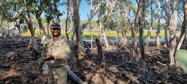
Every Tuesday during the tourist season Ben, a Traditional Owner (TO) and park ranger, conducts a ranger-lead walk around a wetland area adjacent to the Park Headquarters. The walks are scheduled to depart at 8.30am and run for 1.5 hours. We were first to arrive and were met by the two rangers, Robbie and Ben, outside their office and information centre. Numerous vehicles then arrived together and Ben provided the obligatory safety briefing to the final group of about 12 people. This briefing included a reminder that saltwater crocodiles are present in the wetland lagoon – including the dominant male whom they call “Lipstick”, as his snout is red from territorial disputes with other crocodiles trying to move into his territory. Warnings were also given regarding Western Brown snakes that are typically on the move during these cooler months, seeking food around the edge of the lagoon. King Brown snakes use to be the dominant species but they seem to have disappeared, possibly as a result of cane toads moving into the area.
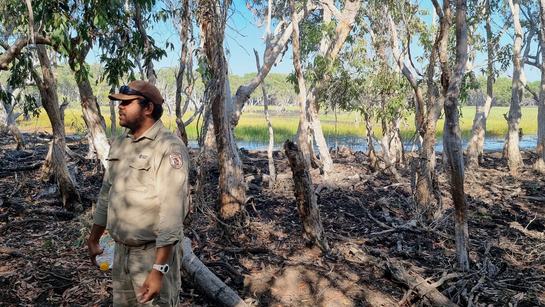
Before setting off for a lap of the wetland (approximately 2kms in distance), Ben included a ‘welcome to country’, then provided some historical background to the country we were on. The land has been continuously occupied by indigenous people for around 40,000 years. Many years ago the Macassans from Indonesia would fish the waters around the northern parts of Australia, especially seeking out trepang. They would trade during the fishing season; signs of their existence on land is evidenced by tamarind trees growing where trepang were caught and processed. Equally, during the dry season, Ben’s grandfather travelled in canoes north to Indonesian islands, returning when the tides and winds changed with the coming of the wet season. As a result, Indonesian culture and words have crept into the local indigenous languages including the words for shirt and rupiah.
Ben talked about the banteng cattle that were originally brought over to the nearby Victoria Settlement in the 1840s. Twenty were landed then – once the settlement failed after 10 years the cattle were let loose and now make up the largest herd of pure-bred banteng in the world. While these cattle are considered feral they command up to USD$17,000 for hunters to bag a trophy. It creates a challenge for the TOs when they are trying to manage the land yet the financial returns from banteng hunting are massive for the local communities. The banteng are difficult to sight as they are nocturnal and won’t be seen during daylight hours, though evidence of where they have been is everywhere – especially along the vehicle tracks.

Ben stopped further along the walk to point out the Strychnine Tree (strychnos lucida) which the traditional owners call ulmbudj. It produces fruit that contains strychnine and other poisonous substances – some early European settlers are rumoured to have provided damper laced with the fruit of the strychnine tree to local indigenous people. The bright orange fruits were used as poison on some ships that arrived from Europe in the 1800s to help manage rats that were eating the provisions – fruit would be collected and scattered amongst the provisions. The rats would have a feast on the fresh fruit; in no time the vermin issue was solved. The sap from the tree is also used to catch fish. Broken limbs from the tree are placed upstream in a creek and the sap deoxygenates the water – the fish rise to the surface and are easy picking for those keen for a meal.
We heard how the missionaries came during the turn of the late 19th century, gathered up children from the peninsula, and took them to the mission on nearby Croker Island. One of the children taken to the island was Ben’s grandfather, taken from his mother when he was 7 years of age. Ben’s great-grandfather was away crocodile hunting at the time and, on his return, heard what had happened so proceeded to paddle over to Croker Island in the still of night and retrieve his son.
The feral pigs are a real problem in the park, as they cause immense damage to the wetlands – foraging for food and eventually damaging the root systems of the trees and plants to the point that they die. Management of the feral pigs is a big part of the ranger’s job, but management can only be done during the wet season when the park is closed to visitors. The most effective management approach is to shoot the feral pigs with high velocity guns. The pigs apparently know that it is safe for them to wander around during the dry season with zero risk of being shot, and will walk without a care by the ranger offices and residences. When the wet season arrives the pigs go into hiding.
The crocodiles are also considered to be a little different to those found in Kakadu, especially to those around Cahill’s Crossing where they grow fat from the easy catches of mullet and barramundi they feed on. On the peninsula the crocodiles are typically ocean feeders, living mainly on turtles. They are often sighted in open water, moving between islands and peninsulas in search of food – as a result the crocodiles grow longer and leaner. They regularly cross from the ocean to the freshwater swamps and lagoons to purge the salt from their system before returning to the ocean in search of more turtles. It was claimed by Ben that only 1 in 1,000 turtles that hatch makes it to maturity – the turtle nests are often raided by large goannas before the eggs are even hatched and many hatchlings that do make it to the surface are picked off by birds (or schools of fish if they find their way into the ocean).
Lots of discussion covered the transition of older traditions and laws that clash with the modern day laws of Australia. Traditionally, issues of respect require that male and female members of the family move in different circles to avoid interbreeding – these are strictly enforced and, for example, require the segregation of brothers and sisters after a certain age. These rules, however, don’t fly in the modern world and need to be relaxed so that families can (for instance) travel in the same car. Ben explained that his mum has no one photo of all 6 of her children – the family photos on display in her home have him and his brothers in some, his 3 sisters others.
The topic of “TO”s was raised. Ben described that the title ‘Traditional Owner’ had to be earned and wasn’t a given right. TOs would have to show that their father’s father was a TO and demonstrate knowledge of country. On turning 18 they would be entitled to a share of the income generated by their “country” in terms of royalties from mines or concessions such as tourist facilities and pastoral leases. TOs also have a say in how “country” is to be managed and used. Often the issues being considered clash with Ben’s role as Park Ranger. He used an example of the government proposing to erect a vermin-proof fence across the bottom of the peninsula to help manage the influx of feral cats. When the TOs considered this they worried about how the fence might impact the movement of banteng and place the revenue made from hunting the Bali cattle in jeopardy. The construction of the fence went no further, even though it was the right thing to do from a National Park perspective.
We came away from the ‘walk and talk’ with an improved understanding of life through the eyes of a traditional owner and the constant challenges he and his family have to navigate living in two worlds.
On return to our camp site we enjoyed morning tea under the shade of a large shade cloth suspended over part of the Tvan. A table and seating to the rear of the Tvan remains in shade from about 10.00am onwards and it is well positioned to catch the sea breeze. As a result we do find we spend a portion of the day seated there – either reading, planning meals and creating shopping lists for when we next find a supermarket, or writing about what we have been up to throughout the day. With so much discussed by Ben during the ‘walk and talk’ earlier in the day, much time was spent in the shade enjoying the breeze while trying to recount what was covered.
After a few chores around camp – and after starting to pack things away for a Thursday morning departure – we decided to repeat the wetland drive and hopefully spot an elusive banteng as it makes an appearance towards the end of the day. The afternoon was starting to cool off and the sea breeze had all but disappeared when we set off on the drive. We again took a wrong turn before realising the error of our ways, retraced our path, and were soon back on the correct track.
The wetlands drive is possibly 10kms all up, with three places where you can park and take in views of the lagoons and waterways from the comfort of your car. This is ideal for many reasons but possibly the most important is that you can avoid the mosquitoes who will always make their presence felt. (The second, equally important reason is that it provides a barrier between ourselves and anything that might emerge from the water or walk by on its way to greener pastures).

Our binoculars scanned the wetlands for signs of wildlife. Birds were in abundance, with white egrets easy to spot against the green background of the reeds that grow prolifically in the lagoon. Small ducks swam by, but there were no sightings of anything larger. We moved on to another vantage point and continued scanning for larger animals without success. The sun had almost set when we returned to our campsite. Chris lit the fire that was soon providing a flickering red and orange light over our campsite that unfortunately did nothing to deter the mosquitoes.
New campers moved into the campsite vacated by Peter and Brian. We will no doubt cross paths and exchange pleasantries tomorrow.
Wednesday 14th August – A slight change of plans
Our plans have been modified to include a quick detour to Darwin in order to catch up with a colleague from Wendy’s work who has been on assignment in Darwin for 18 months. We now aim to leave the Cobourg Peninsula a day earlier than planned and make our way to Darwin for a catchup dinner on Friday night. We can then head south to Katherine / Mataranka and pick up our planned journey from there. Calculations have been done and we need to be at Cahill’s Crossing at around 1.30pm if we are to cross at low tide. Given it took us 5 hours (including a stop at Injalak Art Community) to get here, we should be fine if we aim to be away by around 8.30am.
Chris has met one of the three young people camping at the adjoining site – the ones who turned up late yesterday afternoon. He heard their tale of woe about how they were towing a boat up to the campground but it didn’t make it and had to be left on the side of the road, where the axle had separated from the trailer. They contacted the emergency towing service in Jabiru who were hopefully picking up the remainder of the trailer – and the boat – last night for a $1,500 recovery fee. The boat and trailer then need to be returned to Darwin by another carrier. The boat also had a lot of their gear in it, which they had no room for in their vehicle so this morning they were doing a stocktake of what they do have in their Toyota 4WD.
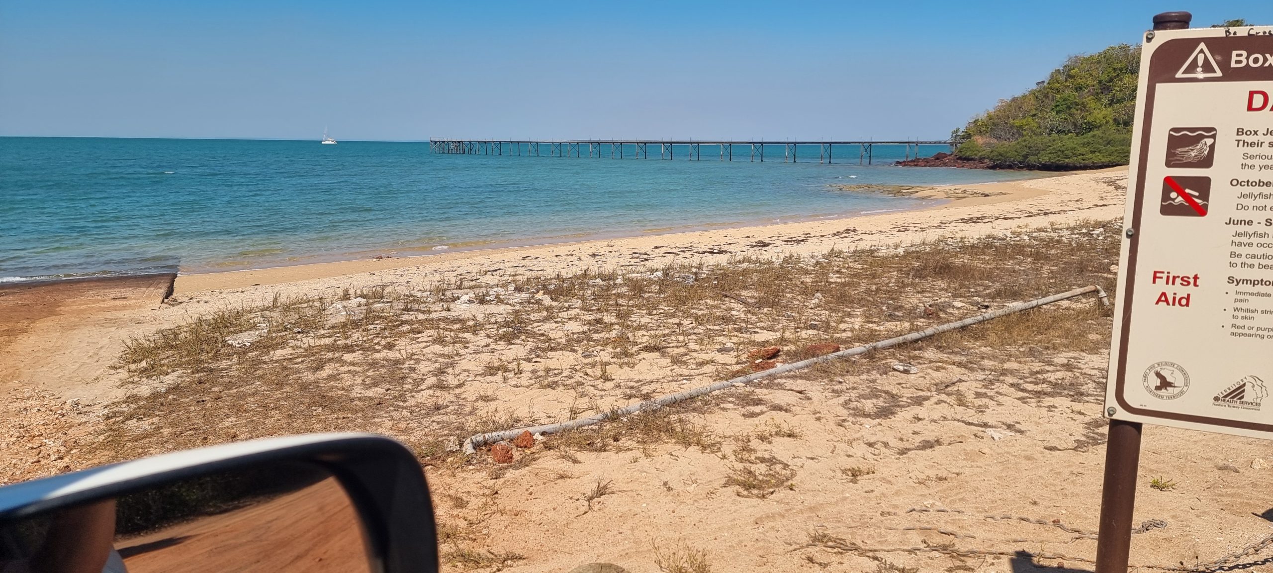
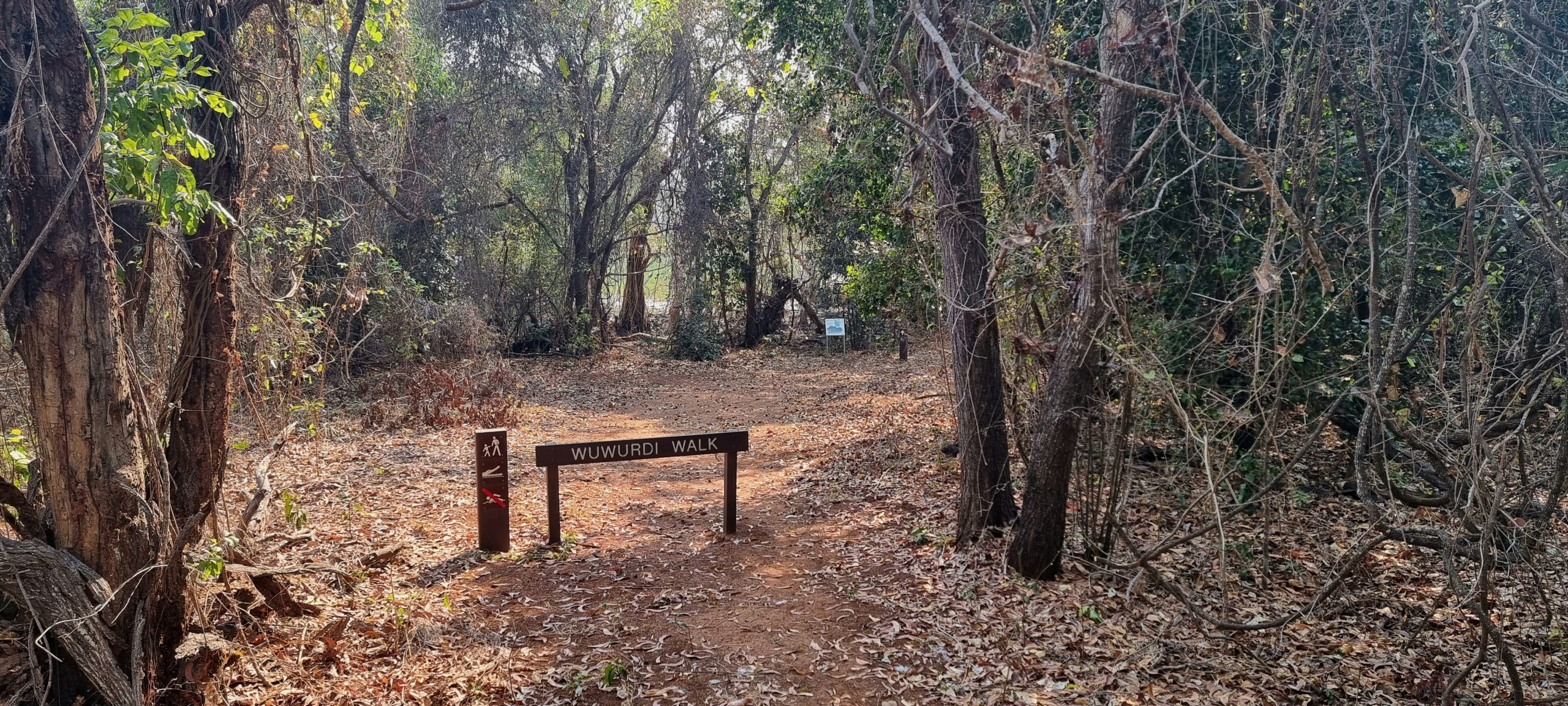
After breakfast we returned to the ranger station to undertake the walk we did yesterday at our own pace. The Wuwurdi walk passes through a mixture of country – from tall paperbarks around the edge of the freshwater lagoon, to lush pandanus forest, to dry forest of ironwood trees (used for making spears and woomeras) and dry foreshore dune country. On returning to the ranger station we spent ages reading the material and inspecting the items on display in the Cultural Centre. There was much information about the extensive history of the region, through to anecdotal accounts of an Indonesian fisherman who, in the early 2000s, drifted at sea in stormy weather and finally landed (24 days later) on the peninsula. There was much to be read about a steamship wrecked on the adjoining peninsula after it was caught in the currents of a large tide. The wreck remains on the reef and is a popular dive site for enthusiasts – those who are OK with diving in waters frequented by crocodiles and sharks!


Following lunch we started packing up the things we’ll no longer need at this campsite. The ensuite was packed away, along with the solar panel once we had achieved more than enough charge in the Tvan to get us well into tomorrow (when the connection to the car will take over). The clothes line will get packed away after dinner, once our towels are dry after our late afternoon shower. We may pack away the awning tonight, to avoid having to pack it away wet with overnight condensation. That can wait until after dinner.
A quick drive down to a popular nearby point where limited mobile phone reception is available kept us busy for some time. The light breeze on the elevated headland above the beach below made it very comfortable while checking emails, text messages and the occasional news headline.
Our remaining firewood has been donated to the recently-arrived neighbours, as we had packed away our fire pit earlier in the afternoon. It saved them from having to set out and gather some for themselves and they were most appreciative of the gesture. They had heard from the Jabiru emergency rescue service who confirmed that their boat (a tinny) and broken trailer had been recovered. It is now waiting for them to return and make arrangements to have the boat plus trailer returned to Darwin for repairs. We also learnt that the couple currently live in Victor Harbour but have recently bought a house near the Darwin Yacht Club – on the coast, overlooking the water. They were specifically after a two-storey residence – they plan to rent out the upstairs section of the house and retain access to the downstairs rooms. That way they will be able to use downstairs as a base for travel across the top end of Australia during the dry season, then lock it up and return south for the summer months.
Our hot shower at the end of the day has washed away some of the accumulated grime, although we suspect that Chris’s feet in particular will not be clean until a lengthy soak in the warm waters of Bitter Springs in a couple of days. It’s back on the road again tomorrow, retracing our tracks back to Jabiru before heading to the “big smoke” that is Darwin on Friday.